
ไฟล์:Map of federal subjects of Russia (2022), disputed Crimea and Donbass.svg

ขนาดของตัวอย่าง PNG นี้ของไฟล์ SVG นี้: 512 × 282 พิกเซล ความละเอียดอื่น: 320 × 176 พิกเซล | 640 × 353 พิกเซล | 1,024 × 564 พิกเซล | 1,280 × 705 พิกเซล | 2,560 × 1,410 พิกเซล
ดูภาพที่มีความละเอียดสูงกว่า ((ไฟล์ SVG, 512 × 282 พิกเซล, ขนาดไฟล์: 827 กิโลไบต์))
| รูปภาพหรือไฟล์เสียงนี้ ต้นฉบับอยู่ที่ คอมมอนส์ รายละเอียดด้านล่าง เป็นข้อความที่แสดงผลจาก ไฟล์ต้นฉบับในคอมมอนส์
|
,_disputed_Crimea_and_Donbass.svg)
 ไฟล์สื่อนี้ได้ถูกแจ้งลบ ตั้งแต่ 1 พฤษภาคม 2024. สำหรับการอภิปราย กรุณาไปที่ หน้าการแจ้งลบ.
อย่านำป้ายนี้ออกจนกว่าการแจ้งลบจะได้ข้อยุติ เหตุผลที่แจ้งลบ: на даному файлі показано незаконно захоплені території АР Крим. Що являється пропагандою тероризму, а також та оправданням війни.
| |||
| |||
,_disputed_Crimea_and_Donbass.svg)
,_disputed_Crimea_and_Donbass.svg)

|
The boundaries on this map show the de facto situation. This is just one of several different views on the subject (see COM:NPOV). |
ความย่อ
| คำอธิบาย |
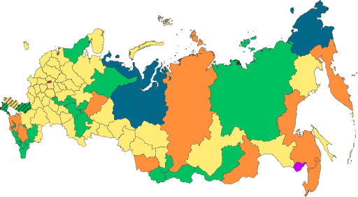
English: Copy of File:Map of federal subjects of Russia (2022).svg with disputed annexed Ukrainian territories indicated with diagonal stripes |
| วันที่ | |
| แหล่งที่มา |
This file was derived from: Map of federal subjects of Russia 2014, disputed Crimea.svg |
| ผู้สร้างสรรค์ | Mzajac, Ltbubbas |
.svg)
การอนุญาตใช้สิทธิ
| This map is ineligible for copyright and therefore in the public domain, because it consists entirely of information that is common property and contains no original authorship. For more information, see Commons:Threshold of originality § Maps.
|
ประวัติไฟล์
คลิกวันที่/เวลาเพื่อดูไฟล์ที่ปรากฏในขณะนั้น
| วันที่/เวลา | รูปย่อ | ขนาด | ผู้ใช้ | ความเห็น | |
|---|---|---|---|---|---|
| ปัจจุบัน | 02:48, 5 ตุลาคม 2565 | | 512 × 282 (827 กิโลไบต์) | Techso01 | Uploaded a work by Mzajac, Ltbubbas from {{derived from|Map of federal subjects of Russia (2014), disputed Crimea.svg}} with UploadWizard |
หน้าที่มีภาพนี้
หน้าต่อไปนี้ โยงมาที่ภาพนี้:
การใช้ไฟล์ข้ามโครงการ
วิกิอื่นต่อไปนี้ใช้ไฟล์นี้:
- การใช้บน ab.wikipedia.org
- การใช้บน ar.wikipedia.org
- การใช้บน ast.wikipedia.org
- การใช้บน be.wikipedia.org
- การใช้บน cs.wikipedia.org
- การใช้บน de.wikipedia.org
- การใช้บน en.wikipedia.org
- การใช้บน es.wikipedia.org
- การใช้บน fa.wikipedia.org
- การใช้บน fr.wikipedia.org
- การใช้บน is.wikipedia.org
- การใช้บน it.wikipedia.org
- การใช้บน ja.wikipedia.org
- การใช้บน ko.wikipedia.org
- การใช้บน la.wikipedia.org
- การใช้บน lez.wikipedia.org
- การใช้บน lld.wikipedia.org
- การใช้บน lt.wikipedia.org
- การใช้บน lv.wikipedia.org
- การใช้บน mi.wikipedia.org
- การใช้บน oc.wikipedia.org
- การใช้บน pt.wikipedia.org
- การใช้บน ru.wikipedia.org
- การใช้บน sl.wikipedia.org
- การใช้บน sr.wikipedia.org
- การใช้บน tly.wikipedia.org
- การใช้บน tum.wikipedia.org
- การใช้บน uk.wikipedia.org
- การใช้บน uz.wikipedia.org
- การใช้บน vi.wikipedia.org
- การใช้บน vls.wikipedia.org
ดูการใช้ข้ามโครงการเพิ่มเติมของไฟล์นี้
,_disputed_Crimea_and_Donbass.svg)
,_disputed_Crimea_and_Donbass.svg)