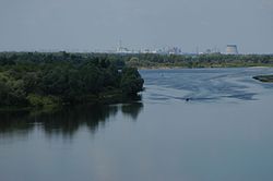
แม่น้ำปรือปิยัจ
หน้าตา
(เปลี่ยนทางจาก แม่น้ำปรีเปียต)
| แม่น้ำปรือปิยัจ | |
|---|---|
 | |
 เส้นทางแม่น้ำปรือปิยัจ | |
| ที่ตั้ง | |
| ประเทศ | ยูเครน, เบลารุส |
| ลักษณะทางกายภาพ | |
| ต้นน้ำ | |
| • ตำแหน่ง | แคว้นวอลึญ ประเทศยูเครน |
| • พิกัด | 51°28′05″N 24°18′54″E / 51.468°N 24.315°E |
| ปากน้ำ | แม่น้ำนีเปอร์ |
• ตำแหน่ง | อ่างเก็บน้ำเคียฟ |
• พิกัด | 51°09′31″N 30°29′27″E / 51.15861°N 30.49083°E |
| ความยาว | 761 กิโลเมตร (473 ไมล์) |
| พื้นที่ลุ่มน้ำ | 121,000 ตารางกิโลเมตร (47,000 ตารางไมล์) |
| อัตราการไหล | |
| • เฉลี่ย | 377 cubic metre per second (13,300 cubic foot per second) |
| ลุ่มน้ำ | |
| ลำดับแม่น้ำ | นีเปอร์→ ชะวากทะเลนีเปอ–Bug→ ทะเลดำ |
| ลำน้ำสาขา | |
| • ซ้าย | Pina, Yaselda, Tsna, Lan, Sluch, Ptsich, Brahinka |
| • ขวา | Turiya, Stokhid, Styr, Horyn, Stsviha, Ubort, Zhelon, Slovechna, Uzh |


แม่น้ำปรือปิยัจ (ยูเครน: При́п'ять; เบลารุส: Пры́пяць; โปแลนด์: Prypeć; รัสเซีย: Припять) เป็นแม่น้ำในยุโรปตะวันออก มีความยาวราว 761 กิโลเมตร (473 ไมล์)[1] ไหลไปทางตะวันออกผ่านประเทศยูเครน เบลารุส และกลับมายูเครนอีกครั้ง ไหลลงสู่แม่น้ำนีเปอร์
อ้างอิง
[แก้]- Припять, Great Soviet Encyclopedia
- Pripyat // Dictionary of Contemporary Geographical Names / Rus. geogr. oh Moscow center; By common. Ed. acad. V. M. Kotlyakova. Institute of Geography, Russian Academy of Sciences. - Yekaterinburg: U-Factorium, 2006.
- Joint River Management Program. Final Report: River Pripyat Basin (February 2004)
- ↑ "Main Geographic Characteristics of the Republic of Belarus. Main characteristics of the largest rivers of Belarus". Land of Ancestors. Data of the Ministry of Natural Resources and Environmental Protection of the Republic of Belarus. 2011. คลังข้อมูลเก่าเก็บจากแหล่งเดิมเมื่อ 15 January 2014. สืบค้นเมื่อ 27 September 2013.
แหล่งข้อมูลอื่น
[แก้]![]() วิกิมีเดียคอมมอนส์มีสื่อเกี่ยวกับ แม่น้ำปรือปิยัจ
วิกิมีเดียคอมมอนส์มีสื่อเกี่ยวกับ แม่น้ำปรือปิยัจ
