
ไฟล์:Saint Vincent and the Grenadines relief location map.jpg

ขนาดของตัวอย่างนี้: 477 × 599 พิกเซล ความละเอียดอื่น: 191 × 240 พิกเซล | 382 × 480 พิกเซล | 611 × 768 พิกเซล | 1,060 × 1,332 พิกเซล
ดูภาพที่มีความละเอียดสูงกว่า (1,060 × 1,332 พิกเซล, ขนาดไฟล์: 194 กิโลไบต์, ชนิดไมม์: image/jpeg)
| รูปภาพหรือไฟล์เสียงนี้ ต้นฉบับอยู่ที่ คอมมอนส์ รายละเอียดด้านล่าง เป็นข้อความที่แสดงผลจาก ไฟล์ต้นฉบับในคอมมอนส์
|
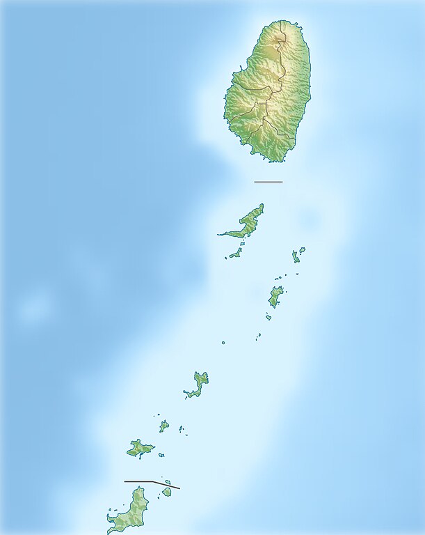
| คำอธิบาย |
Deutsch: Physische Positionskarte von St. Vincent und die Grenadinen
Geographische Begrenzung der Karte:
English: Location map of Saint Vincent und the Grenadines
Geographic limits of the map:
|
| วันที่ | |
| แหล่งที่มา |
งานของตัว, using
|
| ผู้สร้างสรรค์ | Carport |
| การอนุญาต (การใช้ไฟล์นี้ใหม่) |
ไฟล์นี้อยู่ภายใต้สัญญาอนุญาต ครีเอทีฟคอมมอนส์ แบบแสดงที่มา-อนุญาตแบบเดียวกัน 3.0 ต้นฉบับ
|
| เวอร์ชันอื่น |
|

ประวัติไฟล์
คลิกวันที่/เวลาเพื่อดูไฟล์ที่ปรากฏในขณะนั้น
| วันที่/เวลา | รูปย่อ | ขนาด | ผู้ใช้ | ความเห็น | |
|---|---|---|---|---|---|
| ปัจจุบัน | 17:52, 1 มกราคม 2556 | | 1,060 × 1,332 (194 กิโลไบต์) | Carport | {{Information |Description= {{de|Physische Positionskarte von St. Vincent und die Grenadinen}} Geographische Begrenzung der Karte: * N: 13.42° N * S: 12.44° N * W: 61.7° W * O: 60.9° W {{en|Location map of [[:... |
หน้าที่มีภาพนี้
หน้าต่อไปนี้ โยงมาที่ภาพนี้:
การใช้ไฟล์ข้ามโครงการ
วิกิอื่นต่อไปนี้ใช้ไฟล์นี้:
- การใช้บน ar.wikipedia.org
- การใช้บน ast.wikipedia.org
- การใช้บน az.wikipedia.org
- การใช้บน bg.wikipedia.org
- การใช้บน bn.wikipedia.org
- การใช้บน bs.wikipedia.org
- การใช้บน ceb.wikipedia.org
- การใช้บน da.wikipedia.org
- การใช้บน de.wikipedia.org
- St. Vincent und die Grenadinen
- Mustique
- Bequia
- Soufrière (St. Vincent)
- Union Island
- Canouan
- Tobago Cays
- Mayreau
- Palm Island (Grenadinen)
- Wikipedia:Kartenwerkstatt/Positionskarten/Nordamerika
- Petit St. Vincent
- Baliceaux
- Vorlage:Positionskarte St. Vincent und die Grenadinen
- Young Island (Grenadinen)
- Pigeon Island (Grenadinen)
- Saint Elairs Cay
- Samples Cay
- Grand Bonhomme
- All Awash Island
- Big Pillory
- Middle Pillory
- Little Pillory
- Rabbit Island (Grenadinen)
- Savan Island
- Little Savan
- Petit Canouan
- Petite Nevis
- Petite Mustique
- Isle à Quatre
- Wallilabou Bay
- Petit Bonhomme (St. Vincent)
- Mount Saint Andrew
- Milligan Cay
- Bettowia
- Church Cay
ดูการใช้ข้ามโครงการเพิ่มเติมของไฟล์นี้