ไฟล์:Pacific elevation.jpg

ขนาดของตัวอย่างนี้: 632 × 599 พิกเซล ความละเอียดอื่น: 253 × 240 พิกเซล | 506 × 480 พิกเซล | 810 × 768 พิกเซล | 1,080 × 1,024 พิกเซล | 2,500 × 2,370 พิกเซล
ดูภาพที่มีความละเอียดสูงกว่า (2,500 × 2,370 พิกเซล, ขนาดไฟล์: 899 กิโลไบต์, ชนิดไมม์: image/jpeg)
ประวัติไฟล์
คลิกวันที่/เวลาเพื่อดูไฟล์ที่ปรากฏในขณะนั้น
| วันที่/เวลา | รูปย่อ | ขนาด | ผู้ใช้ | ความเห็น | |
|---|---|---|---|---|---|
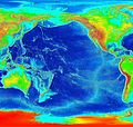
| ปัจจุบัน | 10:41, 7 มีนาคม 2549 |  | 2,500 × 2,370 (899 กิโลไบต์) | Interiot~commonswiki | Elevation of the Pacific ocean Source: http://www.ngdc.noaa.gov/mgg/image/2minrelief.html |
หน้าที่มีภาพนี้
ไม่มีหน้าใดโยงมาที่ภาพนี้
การใช้ไฟล์ข้ามโครงการ
วิกิอื่นต่อไปนี้ใช้ไฟล์นี้:
- การใช้บน als.wikipedia.org
- การใช้บน ang.wikipedia.org
- การใช้บน ar.wikipedia.org
- การใช้บน avk.wikipedia.org
- การใช้บน azb.wikipedia.org
- การใช้บน az.wikipedia.org
- การใช้บน bat-smg.wikipedia.org
- การใช้บน be.wikipedia.org
- การใช้บน bg.wikipedia.org
- การใช้บน bn.wikipedia.org
- การใช้บน bs.wikipedia.org
- การใช้บน ca.wikipedia.org
- การใช้บน ceb.wikipedia.org
- การใช้บน chr.wikipedia.org
- การใช้บน crh.wikipedia.org
- การใช้บน cs.wikipedia.org
- การใช้บน da.wikipedia.org
- การใช้บน de.wikipedia.org
- การใช้บน de.wiktionary.org
- การใช้บน dsb.wikipedia.org
- การใช้บน en.wikipedia.org
- การใช้บน en.wikibooks.org
- การใช้บน es.wikipedia.org
- การใช้บน et.wikipedia.org
- การใช้บน ext.wikipedia.org
- การใช้บน fa.wikipedia.org
- การใช้บน fiu-vro.wikipedia.org
- การใช้บน fi.wikipedia.org
- การใช้บน fj.wikipedia.org
- การใช้บน frr.wikipedia.org
- การใช้บน fy.wikipedia.org
- การใช้บน gan.wikipedia.org
- การใช้บน gd.wikipedia.org
- การใช้บน gl.wikipedia.org
- การใช้บน he.wikipedia.org
- การใช้บน hif.wikipedia.org
- การใช้บน hr.wikipedia.org
- การใช้บน hsb.wikipedia.org
ดูการใช้ข้ามโครงการเพิ่มเติมของไฟล์นี้

