
ไฟล์:Kumage Subprefecture in Kagoshima Prefecture.png

ขนาดของตัวอย่างนี้: 800 × 534 พิกเซล ความละเอียดอื่น: 320 × 213 พิกเซล | 640 × 427 พิกเซล | 1,024 × 683 พิกเซล | 1,201 × 801 พิกเซล
ดูภาพที่มีความละเอียดสูงกว่า (1,201 × 801 พิกเซล, ขนาดไฟล์: 34 กิโลไบต์, ชนิดไมม์: image/png)
| รูปภาพหรือไฟล์เสียงนี้ ต้นฉบับอยู่ที่ คอมมอนส์ รายละเอียดด้านล่าง เป็นข้อความที่แสดงผลจาก ไฟล์ต้นฉบับในคอมมอนส์
|
ความย่อ
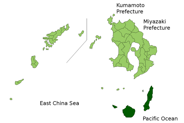
| คำอธิบาย | Location Map of Kumage Subprefecture in Kagoshima Prefecture, Japan |
| วันที่ | |
| แหล่งที่มา | Image:KagoshimaMapCurrent.png and rework |
| ผู้สร้างสรรค์ | user:alberth2 |
| การอนุญาต (การใช้ไฟล์นี้ใหม่) |
PD |
การอนุญาตใช้สิทธิ
| ข้าพเจ้า ผู้ถือลิขสิทธิ์ในงานนี้ ขอมอบงานให้เป็นสาธารณสมบัติ ประกาศนี้มีผลทั่วโลก ในบางประเทศ การกระทำดังกล่าวอาจไม่สามารถทำได้ตามกฎหมาย ข้าพเจ้าอนุญาตให้ทุกคนมีสิทธิ์ในการใช้ไฟล์นี้ในทุกเหตุผลการใช้ โดยไม่มีมีเงื่อนไข เว้นแต่กฎหมายไม่อนุญาตให้ทำเช่นนั้น |
ประวัติไฟล์
คลิกวันที่/เวลาเพื่อดูไฟล์ที่ปรากฏในขณะนั้น
| วันที่/เวลา | รูปย่อ | ขนาด | ผู้ใช้ | ความเห็น | |
|---|---|---|---|---|---|
| ปัจจุบัน | 13:43, 23 มีนาคม 2553 | | 1,201 × 801 (34 กิโลไบต์) | Alberth2 | Kajiki Town, Kamō Town and Aira Tow were merged to Aira City. |
| 10:09, 1 พฤศจิกายน 2551 |  | 1,201 × 801 (34 กิโลไบต์) | Alberth2 | Ōkuchi and Hishikari merged to Isa. | |
| 13:26, 1 ธันวาคม 2550 |  | 1,201 × 801 (34 กิโลไบต์) | Alberth2 | Kawanabe, Chiran, and Ei are merged into Minamikyūshū City. | |
| 08:20, 5 ตุลาคม 2550 |  | 1,201 × 801 (34 กิโลไบต์) | Alberth2 | == Summary == {{Information |Description=Location Map of Kumage Subprefecture in Kagoshima Prefecture, Japan |Source=Image:KagoshimaMapCurrent.png and rework |Date=Oct. 5th, 2007 |Author=user:alberth2 |Permission=PD |other_versions= }} == Licens |
หน้าที่มีภาพนี้
หน้าต่อไปนี้ โยงมาที่ภาพนี้:
การใช้ไฟล์ข้ามโครงการ
วิกิอื่นต่อไปนี้ใช้ไฟล์นี้:
- การใช้บน en.wikipedia.org
- การใช้บน nl.wikipedia.org
- การใช้บน pl.wikipedia.org
- การใช้บน zh.wikipedia.org