
ไฟล์:Hernando de Soto Bridge Memphis.jpg

ขนาดของตัวอย่างนี้: 625 × 599 พิกเซล ความละเอียดอื่น: 250 × 240 พิกเซล | 501 × 480 พิกเซล | 801 × 768 พิกเซล | 1,068 × 1,024 พิกเซล | 1,500 × 1,438 พิกเซล
ดูภาพที่มีความละเอียดสูงกว่า (1,500 × 1,438 พิกเซล, ขนาดไฟล์: 391 กิโลไบต์, ชนิดไมม์: image/jpeg)
| รูปภาพหรือไฟล์เสียงนี้ ต้นฉบับอยู่ที่ คอมมอนส์ รายละเอียดด้านล่าง เป็นข้อความที่แสดงผลจาก ไฟล์ต้นฉบับในคอมมอนส์
|
| คำอธิบาย |
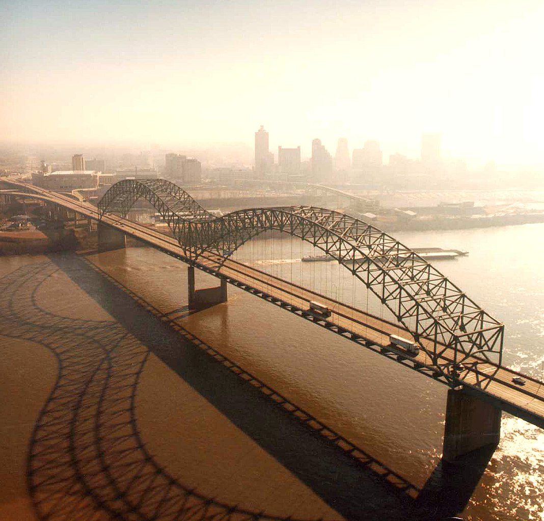
English: Aerial view of the Hernando de Soto Bridge across the Mississippi River between Memphis, Tennessee and West Memphis, Arkansas, USA. The bridge was opened in 1973 and carries six lanes of Interstate-40 across the river. View is from the Arkansas side to the east-southeast across the river to Memphis.
At thumbnail size, image appears clear, at the size on the image page small artifacts can be seen, but at 100% (actual size) the image is heavily artifacted with JPG compression blocks over the entire photograph. |
|||
| วันที่ | ||||
| แหล่งที่มา |
U.S. Army Corps of Engineers Digital Visual Library Image page Image description page Digital Visual Library home page |
|||
| ผู้สร้างสรรค์ | Larry Donald, U.S. Army Corps of Engineers | |||
| การอนุญาต (การใช้ไฟล์นี้ใหม่) |
|
|||
| Location | Memphis, Tennessee, USA |
| ตำแหน่งที่ตั้งกล้อง | | ภาพนี้และภาพอื่น ๆ ณ สถานที่เดียวกันที่ OpenStreetMap |
|---|
ประวัติไฟล์
คลิกวันที่/เวลาเพื่อดูไฟล์ที่ปรากฏในขณะนั้น
| วันที่/เวลา | รูปย่อ | ขนาด | ผู้ใช้ | ความเห็น | |
|---|---|---|---|---|---|
| ปัจจุบัน | 08:34, 6 เมษายน 2550 | | 1,500 × 1,438 (391 กิโลไบต์) | DanMS | {{Information | Description = {{en|Aerial view of the Hernando de Soto Bridge across the Mississippi River between Memphis, Tennessee and West Memphis, Arkansas, USA. The bridge was opened in 1973 and carries six lanes of Interstate-40 across the river |
หน้าที่มีภาพนี้
หน้าต่อไปนี้ โยงมาที่ภาพนี้:
การใช้ไฟล์ข้ามโครงการ
วิกิอื่นต่อไปนี้ใช้ไฟล์นี้:
- การใช้บน ar.wikipedia.org
- การใช้บน arz.wikipedia.org
- การใช้บน ast.wikipedia.org
- การใช้บน bo.wikipedia.org
- การใช้บน cs.wikipedia.org
- การใช้บน de.wikipedia.org
- การใช้บน en.wikipedia.org
- Interstate 40
- Talk:List of longest arch bridge spans
- Wikipedia:What is a featured picture?/Examples of technical problems
- Image quality
- Interstate 40 in Tennessee
- Wikipedia:Featured picture candidates/January-2008
- Wikipedia:Featured picture candidates/Image:Hernando de Soto Bridge Memphis.jpg
- Culture of Memphis, Tennessee
- การใช้บน en.wikivoyage.org
- การใช้บน eo.wikipedia.org
- การใช้บน es.wikipedia.org
- การใช้บน fa.wikipedia.org
- การใช้บน fr.wikipedia.org
- การใช้บน fr.wikibooks.org
- การใช้บน fy.wikipedia.org
- การใช้บน gl.wikipedia.org
- การใช้บน gu.wikipedia.org
- การใช้บน hi.wikipedia.org
- การใช้บน hu.wikipedia.org
- การใช้บน id.wikipedia.org
- การใช้บน io.wikipedia.org
- การใช้บน ja.wikipedia.org
- การใช้บน la.wikipedia.org
- การใช้บน mr.wikipedia.org
- การใช้บน pl.wikipedia.org
- การใช้บน ru.wikipedia.org
- การใช้บน sh.wikipedia.org
ดูการใช้ข้ามโครงการเพิ่มเติมของไฟล์นี้