
ไฟล์:Census Bureau map of Trenton, New Jersey.png
ไม่มีภาพที่มีรายละเอียดสูงกว่านี้
Census_Bureau_map_of_Trenton,_New_Jersey.png (575 × 425 พิกเซล, ขนาดไฟล์: 69 กิโลไบต์, ชนิดไมม์: image/png)
| รูปภาพหรือไฟล์เสียงนี้ ต้นฉบับอยู่ที่ คอมมอนส์ รายละเอียดด้านล่าง เป็นข้อความที่แสดงผลจาก ไฟล์ต้นฉบับในคอมมอนส์
|
ความย่อ
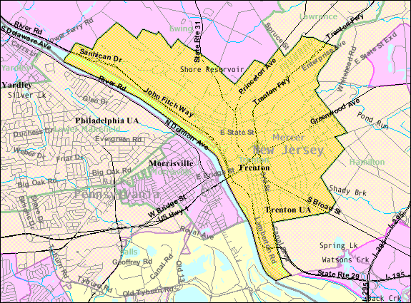
| คำอธิบาย |
English: Census Bureau map of Trenton |
| แหล่งที่มา | [1] |
| ผู้สร้างสรรค์ | United States Census Bureau |
การอนุญาตใช้สิทธิ
This image or file is a work of a United States Census Bureau employee, taken or made as part of that person's official duties. As a work of the U.S. federal government, the image is in the public domain.
|
 |
บันทึกการอัพโหลด
นำเข้าจาก en.wikipedia มายังคอมมอนส์ โดย Quadell โดยใช้ CommonsHelper
The original description page was here. All following user names refer to en.wikipedia.
- 2011-02-08 20:59 Alansohn 575×425× (69525 bytes) {{Information |Description = Census Bureau map of [[Trenton, New Jersey]] |Source = [http://factfinder.census.gov/servlet/MapItDrawServlet?geo_id=16000US3474000&_bucket_id=49&tree_id=339&context=saff&_lang=en&_sse=on] |Date = ~~~~~
บันทึกการอัพโหลด
| วันที่/เวลา | ขนาด | ผู้ใช้ | ความเห็น |
|---|---|---|---|
| 4 กรกฎาคม พ.ศ. 2556, 20:38:07 | 575 × 425 (69525 bytes) | File Upload Bot (Magnus Manske) (คุย · ส่วนร่วม) | Transfered from en.wikipedia by [[User:Quadell]] using CommonsHelper |
ประวัติไฟล์
คลิกวันที่/เวลาเพื่อดูไฟล์ที่ปรากฏในขณะนั้น
| วันที่/เวลา | รูปย่อ | ขนาด | ผู้ใช้ | ความเห็น | |
|---|---|---|---|---|---|
| ปัจจุบัน | 04:05, 21 พฤศจิกายน 2557 | | 575 × 425 (69 กิโลไบต์) | GifTagger | Bot: Converting file to superior PNG file. (Source: Census_Bureau_map_of_Trenton,_New_Jersey.gif). This GIF was problematic due to non-greyscale color table. |
หน้าที่มีภาพนี้
หน้าต่อไปนี้ โยงมาที่ภาพนี้:
การใช้ไฟล์ข้ามโครงการ
วิกิอื่นต่อไปนี้ใช้ไฟล์นี้:
- การใช้บน azb.wikipedia.org
- การใช้บน bn.wikipedia.org
- การใช้บน en.wikipedia.org
- การใช้บน fi.wikipedia.org
- การใช้บน ja.wikipedia.org
- การใช้บน ml.wikipedia.org
- การใช้บน new.wikipedia.org
- การใช้บน simple.wikipedia.org
- การใช้บน ur.wikipedia.org
- การใช้บน zh.wikipedia.org