ไฟล์:BlankMap-World-1985.png
ไม่รองรับเนื้อหาของหน้าในภาษาอื่น
จากวิกิพีเดีย สารานุกรมเสรี

ดูภาพที่มีความละเอียดสูงกว่า(1,500 × 740 พิกเซล, ขนาดไฟล์: 90 กิโลไบต์, ชนิดไมม์: image/png)

Wikimedia Commons logo รูปภาพหรือไฟล์เสียงนี้ ต้นฉบับอยู่ที่ คอมมอนส์ รายละเอียดด้านล่าง เป็นข้อความที่แสดงผลจาก ไฟล์ต้นฉบับในคอมมอนส์
คอมมอนส์เป็นเว็บไซต์ในโครงการสำหรับเก็บรวบรวมสื่อเสรี ที่ คุณสามารถช่วยได้
ภาพนี้มีภาพในรูปแบบเวกเตอร์ (SVG)
หากภาพ SVG ทำให้การแสดงผลดีกว่า หน้าที่ใช้ภาพนี้ควรเปลี่ยนไปใช้ภาพ SVG แทน

File:BlankMap-World-1985.png → File:BlankMap-World 1985.svg

สำหรับข้อมูลเพิ่มเติมเกี่ยวกับภาพเวกเตอร์ ดูที่ การเปลี่ยนไปใช้ภาพ SVG ในคอมมอนส์
นอกจากนี้สามารถดูเพิ่มเติมเกี่ยวกับ ข้อมูลเกี่ยวกับการรองรับภาพ SVG สำหรับซอฟต์แวร์มีเดียวิกิ ได้

ในภาษาอื่นๆ
Alemannisch  Bahasa Indonesia  Bahasa Melayu  British English  català  čeština  dansk  Deutsch  eesti  English  español  Esperanto  euskara  français  Frysk  galego  hrvatski  Ido  italiano  lietuvių  magyar  Nederlands  norsk bokmål  norsk nynorsk  occitan  Plattdüütsch  polski  português  português do Brasil  română  Scots  sicilianu  slovenčina  slovenščina  suomi  svenska  Tiếng Việt  Türkçe  vèneto  Ελληνικά  беларуская (тарашкевіца)  български  македонски  нохчийн  русский  српски / srpski  татарча/tatarça  українська  ქართული  հայերեն  বাংলা  தமிழ்  മലയാളം  ไทย  한국어  日本語  简体中文  繁體中文  עברית  العربية  فارسی  +/−
ภาพ SVG

ความย่อ

คำอธิบาย

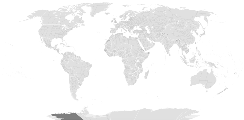
Blank political map of the world c.1985.

This is also officially accurate for the period between 1977 (South Africa imposes direct rule on Walvis Bay) - May 22 1990 (Unification of North and South Yemen). Unofficial border changes occurred between 1977 and 1990 which include in 1979 the US de facto hand over of the Panama Canal Zone to Panama (made official in December 1999) and in December 26, 1981 when the Iraq-Saudi Arabia Neutral Zone was partitioned between Iraq and Saudi Arabia but was only officially accepted in 1991.

Blank maps of the world for historical use
pre-1800

1 · 820 · 1500 · 1710


19th century

1840 · 1861 · 1866 · 1872 · 1898


20th century

1902 · 1912 · 1914 · WWI · Aug 1918 · 1920 · 1921 · 1924 · 1926 · 1935 · 1937 · Mar 1938 · Oct 1938 · Mar 1939 · Oct 1939 · WWII · Nov 1942 · May 1945 · 1957 · 1959 · 1962 · 1968 · 1970 · 1985 · 1990 · 1993


21st century

2000 · 2005 · 2007 · 2009 · Current

(this template: · view · discuss )
วันที่ originally created before 13 พฤษภาคม พ.ศ. 2548
date QS:P,+2005-05-13T00:00:00Z/7,P1326,+2005-05-13T00:00:00Z/11
แหล่งที่มา from wikipedia
ผู้สร้างสรรค์ several/unknown authors from Wikipedia/Commons; see บันทึกการอัพโหลด and file upload log below for the latest
เวอร์ชันอื่น

ไฟล์อื่นที่ใช้ไฟล์นี้:

การอนุญาตใช้สิทธิ

w:th:ครีเอทีฟคอมมอนส์
แสดงที่มา อนุญาตแบบเดียวกัน
ไฟล์นี้อยู่ภายใต้สัญญาอนุญาต ครีเอทีฟคอมมอนส์ แบบแสดงที่มา-อนุญาตแบบเดียวกัน 3.0 ต้นฉบับ ทั้งนี้ เป็นไปตามข้อปฏิเสธความรับผิดชอบ
คุณสามารถ:
  • ที่จะแบ่งปัน – ที่จะทำสำเนา แจกจ่าย และส่งงานดังกล่าวต่อไป
  • ที่จะเรียบเรียงใหม่ – ที่จะดัดแปลงงานดังกล่าว
ภายใต้เงื่อนไขต่อไปนี้:
  • แสดงที่มา – คุณต้องให้เกียรติเจ้าของงานอย่างเหมาะสม โดยเพิ่มลิงก์ไปยังสัญญาอนุญาต และระบุหากมีการเปลี่ยนแปลง คุณอาจทำเช่นนี้ได้ในรูปแบบใดก็ได้ตามควร แต่ต้องไม่ใช่ในลักษณะที่แนะว่าผู้ให้อนุญาตสนับสนุนคุณหรือการใช้งานของคุณ
  • อนุญาตแบบเดียวกัน – หากคุณดัดแปลง เปลี่ยนรูป หรือต่อเติมงานนี้ คุณต้องใช้สัญญาอนุญาตแบบเดียวกันหรือแบบที่เหมือนกับสัญญาอนุญาตที่ใช้กับงานนี้เท่านั้น
ป้ายแสดงสถานะลิขสิทธิ์นี้ถูกเพิ่มเพื่อให้เป็นไปตามการเปลี่ยนแปลงสัญญาอนุญาตของมูลนิธิวิกิมีเดีย จาก GFDL ไปยัง GFDL ควบคู่กับ CC-BY-SA 3.0
GNU head อนุญาตให้คัดลอก แจกจ่ายและ/หรือดัดแปรเอกสารนี้ภายใต้เงื่อนไขของสัญญาอนุญาตเอกสารเสรีของกนู รุ่น 1.2 หรือรุ่นใด ๆ นับจากนี้ที่ออกโดยมูลนิธิซอฟต์แวร์เสรี โดยไม่มีส่วนใดห้ามแก้ไข ไม่มีข้อความปกหน้าและปกหลัง สำเนาของสัญญาอนุญาตรวมอยู่ในส่วนชื่อ สัญญาอนุญาตเอกสารเสรีของกนู ทั้งนี้ เป็นไปตามข้อปฏิเสธความรับผิดชอบ

บันทึกการอัพโหลด

From enwp File:BlankMap-World-1985.png:

  • 2006-07-01T03:50:46 Hoshie (talk | contribs) uploaded "File:BlankMap-World-1985.png" (Added Walvis Bay and the Trust Territory of the Pacific Islands. See talk.)
  • 2006-03-28T03:55:33 E Pluribus Anthony (talk | contribs) uploaded "File:BlankMap-World-1985.png" (World map: blank, with borders (1985))
  • 2006-03-26T17:41:59 E Pluribus Anthony (talk | contribs) uploaded "File:BlankMap-World-1985.png" (World map: blank, with borders (1985))
  • 2006-01-04T09:34:07 E Pluribus Anthony (talk | contribs) uploaded "File:BlankMap-World-1985.png" (World map: blank, with borders (1985))
  • 2005-09-19T13:49:05 E Pluribus Anthony (talk | contribs) uploaded "File:BlankMap-World-1985.png" (World map: blank, with borders (1985))
  • 2005-09-19T08:06:52 E Pluribus Anthony (talk | contribs) uploaded "File:BlankMap-World-1985.png" (World map: blank, with borders (1985))
  • 2005-09-19T02:56:16 E Pluribus Anthony (talk | contribs) uploaded "File:BlankMap-World-1985.png" (World map: blank, with borders (1985))
  • 2005-09-19T01:09:58 E Pluribus Anthony (talk | contribs) uploaded "File:BlankMap-World-1985.png" (World map: blank, with borders (1985))
  • 2005-05-12T23:25:33 Stern (talk | contribs) uploaded "File:BlankMap-World-1985.png" (minor changes (Denmark, Berlin, Caribbean))
  • other uploads which were not logged

คำบรรยายโดยย่อ

เพิ่มคำบรรยายทรรทัดเดียวเพื่อขยายความว่าไฟล์นี้มีอะไร

ไอเทมที่แสดงอยู่ในไฟล์นี้

ประกอบด้วย

media type อังกฤษ

image/png

checksum อังกฤษ

d6bb7eef1d4554d5327a28d84023923685565f0d

data size อังกฤษ

92,304 ไบต์

740 พิกเซล

1,500 พิกเซล

ประวัติไฟล์

คลิกวันที่/เวลาเพื่อดูไฟล์ที่ปรากฏในขณะนั้น

(ล่าสุด | เก่าสุด) ดู (ใหม่กว่า 10 | ) (10 | 20 | 50 | 100 | 250 | 500)
วันที่/เวลารูปย่อขนาดผู้ใช้ความเห็น
ปัจจุบัน21:56, 10 ธันวาคม 2562รูปย่อสำหรับรุ่นเมื่อ 21:56, 10 ธันวาคม 25621,500 × 740 (90 กิโลไบต์)AKS471883Senegambia
18:04, 10 ตุลาคม 2560รูปย่อสำหรับรุ่นเมื่อ 18:04, 10 ตุลาคม 25601,500 × 740 (104 กิโลไบต์)Expertseeker90Major edits and overhall! Continents, coastlines, lakes, rivers, islands, atolls and reefs added or fixed. National and internal boundaries re positioned and adjusted.
06:13, 8 มกราคม 2556รูปย่อสำหรับรุ่นเมื่อ 06:13, 8 มกราคม 25561,425 × 625 (49 กิโลไบต์)CriostóirThese are the internationally recognised borders of Morocco (and as recognised by the UN)
03:40, 29 ตุลาคม 2555รูปย่อสำหรับรุ่นเมื่อ 03:40, 29 ตุลาคม 25551,425 × 625 (28 กิโลไบต์)ApolikamixitosFixing Morocco borders.
20:08, 13 มิถุนายน 2552รูปย่อสำหรับรุ่นเมื่อ 20:08, 13 มิถุนายน 25521,425 × 625 (49 กิโลไบต์)HoshieAdded a pixel around Timor island, fixed Cabinda (Angola), fixed the border of the Yemens and Saudi Arabia to where it was before the 2000 treaty based on this 1976 map [http://www.lib.utexas.edu/maps/middle_east_and_asia/middle_east_pol_1976.jpg http://w
08:21, 4 ตุลาคม 2550รูปย่อสำหรับรุ่นเมื่อ 08:21, 4 ตุลาคม 25501,425 × 625 (30 กิโลไบต์)R-41~commonswikiRedone version
09:52, 24 กันยายน 2550รูปย่อสำหรับรุ่นเมื่อ 09:52, 24 กันยายน 25501,357 × 628 (45 กิโลไบต์)Hoshieput the (N/S) Yemen boundary in white due to the fact the boundaries in southern Saudi Arabia have been disputed, undemarcated, or undisclosed over the years.
07:47, 6 สิงหาคม 2550รูปย่อสำหรับรุ่นเมื่อ 07:47, 6 สิงหาคม 25501,357 × 628 (45 กิโลไบต์)Hoshieadded Cabinda, under same license as original.
17:53, 24 มกราคม 2550รูปย่อสำหรับรุ่นเมื่อ 17:53, 24 มกราคม 25501,357 × 628 (45 กิโลไบต์)HoshieThe Yemen boundry with Saudi Arabia did not exist until 2000.
11:07, 12 สิงหาคม 2549รูปย่อสำหรับรุ่นเมื่อ 11:07, 12 สิงหาคม 25491,357 × 628 (45 กิโลไบต์)HoshieI have removed the outline of the Trust Territory of the Pacific Islands and moved Walvis Bay down the coast of Namibia.
(ล่าสุด | เก่าสุด) ดู (ใหม่กว่า 10 | ) (10 | 20 | 50 | 100 | 250 | 500)

ไม่มีหน้าใดโยงมาที่ภาพนี้

การใช้ไฟล์ข้ามโครงการ

ข้อมูลเกี่ยวกับภาพ