
ไฟล์:Bayou des Allemands.jpg
ขนาดของตัวอย่างนี้: 800 × 533 พิกเซล ความละเอียดอื่น: 320 × 213 พิกเซล | 640 × 427 พิกเซล | 1,024 × 683 พิกเซล | 1,500 × 1,000 พิกเซล
ดูภาพที่มีความละเอียดสูงกว่า (1,500 × 1,000 พิกเซล, ขนาดไฟล์: 333 กิโลไบต์, ชนิดไมม์: image/jpeg)
| รูปภาพหรือไฟล์เสียงนี้ ต้นฉบับอยู่ที่ คอมมอนส์ รายละเอียดด้านล่าง เป็นข้อความที่แสดงผลจาก ไฟล์ต้นฉบับในคอมมอนส์
|
| คำอธิบาย |
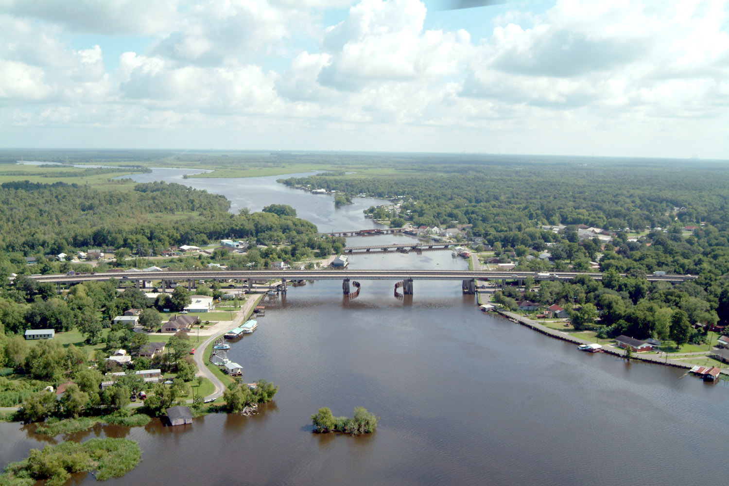
English: Bayou des Allemands and the town of Des Allemands, Louisiana, USA. The bayou is the boundary between St. Charles Parish (right) and Lafourche Parish (left). The three bridges crossing the bayou are (farthest to closest): A railroad bridge, Louisiana State Route 631, and U.S. Route 90. View is to the north. |
|||
| วันที่ | ||||
| แหล่งที่มา |
U.S. Army Corps of Engineers Digital Visual Library Image page Image description page Digital Visual Library home page |
|||
| ผู้สร้างสรรค์ | Lane Lefort, U.S. Army Corps of Engineers | |||
| การอนุญาต (การใช้ไฟล์นี้ใหม่) |
|
|||
| Location | Des Allemands, Louisiana, USA |
| ตำแหน่งที่ตั้งกล้อง | | ภาพนี้และภาพอื่น ๆ ณ สถานที่เดียวกันที่ OpenStreetMap |
|---|
ประวัติไฟล์
คลิกวันที่/เวลาเพื่อดูไฟล์ที่ปรากฏในขณะนั้น
| วันที่/เวลา | รูปย่อ | ขนาด | ผู้ใช้ | ความเห็น | |
|---|---|---|---|---|---|
| ปัจจุบัน | 05:41, 8 เมษายน 2550 | | 1,500 × 1,000 (333 กิโลไบต์) | DanMS | {{Information | Description = {{en|Bayou des Allemands and the town of Des Allemands, Louisiana, USA. The bayou is the boundary between St. Charles Parish (right) and Lafourche Parish (left). The three bridges crossing the bayou are (farthest to closes |
หน้าที่มีภาพนี้
หน้าต่อไปนี้ โยงมาที่ภาพนี้:
การใช้ไฟล์ข้ามโครงการ
วิกิอื่นต่อไปนี้ใช้ไฟล์นี้:
- การใช้บน ar.wikipedia.org
- การใช้บน ca.wikipedia.org
- การใช้บน ceb.wikipedia.org
- การใช้บน ce.wikipedia.org
- การใช้บน cy.wikipedia.org
- การใช้บน de.wikipedia.org
- การใช้บน en.wikipedia.org
- การใช้บน es.wikipedia.org
- การใช้บน fa.wikipedia.org
- การใช้บน fr.wikipedia.org
- การใช้บน fy.wikipedia.org
- การใช้บน it.wikipedia.org
- การใช้บน lld.wikipedia.org
- การใช้บน nl.wikipedia.org
- การใช้บน pl.wikipedia.org
- การใช้บน pt.wikipedia.org
- การใช้บน sh.wikipedia.org
- การใช้บน sr.wikipedia.org
- การใช้บน tt.wikipedia.org
- การใช้บน uk.wikipedia.org
- การใช้บน www.wikidata.org
- การใช้บน zh-min-nan.wikipedia.org
- การใช้บน zh.wikipedia.org