
ไฟล์:Asylum Township.jpg
ขนาดของตัวอย่างนี้: 800 × 494 พิกเซล ความละเอียดอื่น: 320 × 197 พิกเซล | 640 × 395 พิกเซล | 1,024 × 632 พิกเซล | 1,280 × 790 พิกเซล | 2,560 × 1,579 พิกเซล | 3,717 × 2,293 พิกเซล
ดูภาพที่มีความละเอียดสูงกว่า (3,717 × 2,293 พิกเซล, ขนาดไฟล์: 6.88 เมกะไบต์, ชนิดไมม์: image/jpeg)
| รูปภาพหรือไฟล์เสียงนี้ ต้นฉบับอยู่ที่ คอมมอนส์ รายละเอียดด้านล่าง เป็นข้อความที่แสดงผลจาก ไฟล์ต้นฉบับในคอมมอนส์
|
| คำอธิบาย |
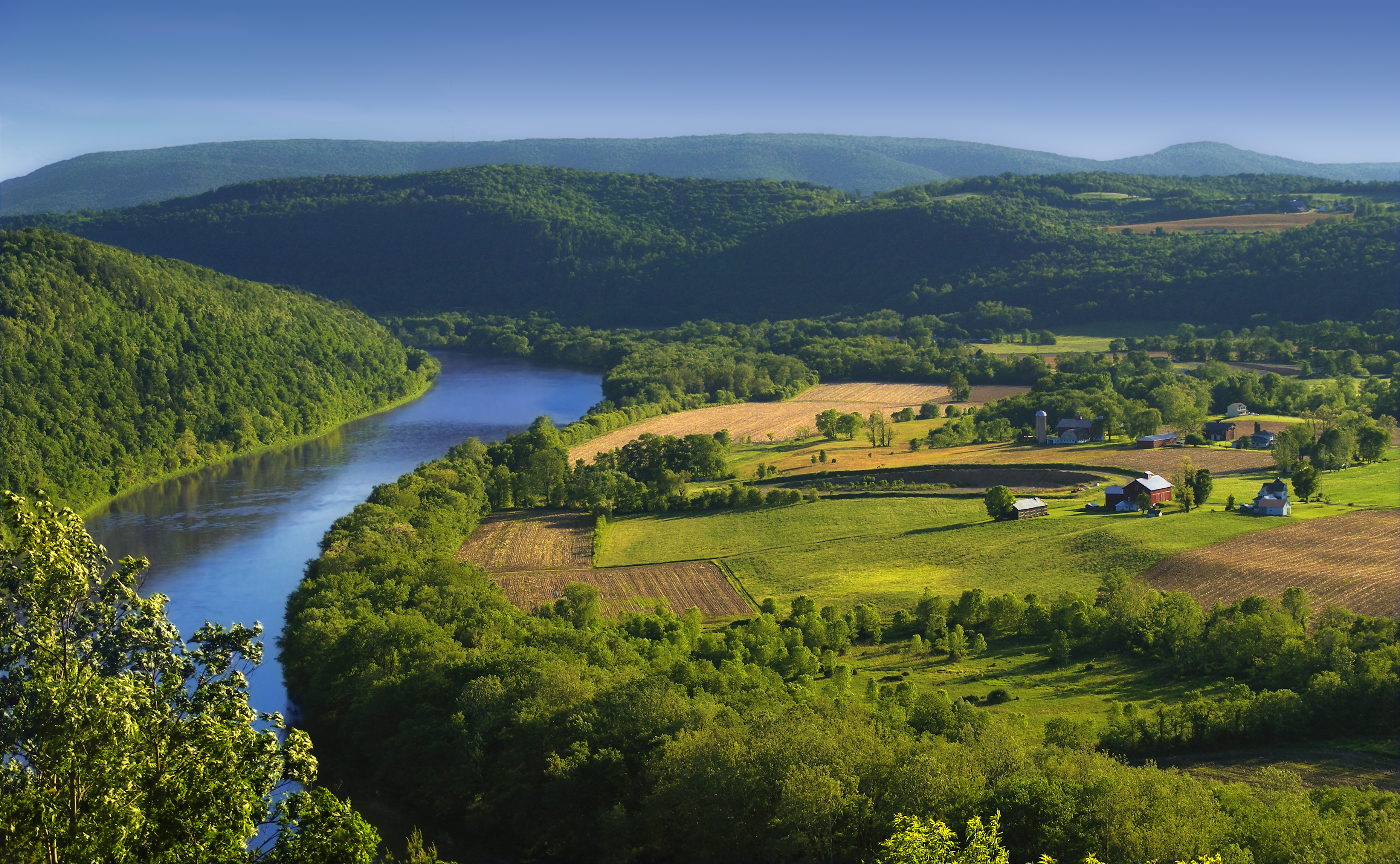
English: The Susquehanna River, Asylum Township, Bradford County, as seen from the Marie Antoinette Lookout off of US Route 6 near Wyalusing in Pennsylvania. Visible from here is the French Azilum Historic Site, where some Revolution-fleeing French aristocrats settled in 1793. It was said that Marie Antoinette planned to settle in a house across the river from the lookout which was allegedly built for her. The marker reads: A settlement of French royalists, who fled the French Revolution in 1793, was established in the valley directly opposite this marker. It was laid out and settled under the direction of Viscount de Noailles and Marquis Antoine Omer Talon. It was hoped that Queen Marie Antoinette might here find safety. Marie Antoinette Lookout, Route 6, Wyalusing, PA. |
||
| วันที่ | |||
| แหล่งที่มา | https://www.flickr.com/photos/nicholas_t/3594274494/ | ||
| ผู้สร้างสรรค์ | Nicholas A. Tonelli from Northeast Pennsylvania, USA | ||
| การอนุญาต (การใช้ไฟล์นี้ใหม่) |
|
| ตำแหน่งที่ตั้งกล้อง | | ภาพนี้และภาพอื่น ๆ ณ สถานที่เดียวกันที่ OpenStreetMap |
|---|
การอนุญาตใช้สิทธิ
ไฟล์นี้อยู่ภายใต้สัญญาอนุญาตครีเอทีฟคอมมอนส์ รุ่น แสดงที่มา 2.0 ทั่วไป
- คุณสามารถ:
- ที่จะแบ่งปัน – ที่จะทำสำเนา แจกจ่าย และส่งงานดังกล่าวต่อไป
- ที่จะเรียบเรียงใหม่ – ที่จะดัดแปลงงานดังกล่าว
- ภายใต้เงื่อนไขต่อไปนี้:
- แสดงที่มา – คุณต้องให้เกียรติเจ้าของงานอย่างเหมาะสม โดยเพิ่มลิงก์ไปยังสัญญาอนุญาต และระบุหากมีการเปลี่ยนแปลง คุณอาจทำเช่นนี้ได้ในรูปแบบใดก็ได้ตามควร แต่ต้องไม่ใช่ในลักษณะที่แนะว่าผู้ให้อนุญาตสนับสนุนคุณหรือการใช้งานของคุณ
ประวัติไฟล์
คลิกวันที่/เวลาเพื่อดูไฟล์ที่ปรากฏในขณะนั้น
| วันที่/เวลา | รูปย่อ | ขนาด | ผู้ใช้ | ความเห็น | |
|---|---|---|---|---|---|
| ปัจจุบัน | 07:49, 6 มิถุนายน 2552 | | 3,717 × 2,293 (6.88 เมกะไบต์) | Flickr upload bot | Uploaded from http://flickr.com/photo/14922165@N00/3594274494 using Flickr upload bot |
หน้าที่มีภาพนี้
หน้าต่อไปนี้ โยงมาที่ภาพนี้:
การใช้ไฟล์ข้ามโครงการ
วิกิอื่นต่อไปนี้ใช้ไฟล์นี้:
- การใช้บน ar.wikipedia.org
- การใช้บน azb.wikipedia.org
- การใช้บน cy.wikipedia.org
- การใช้บน da.wikipedia.org
- การใช้บน en.wikipedia.org
- การใช้บน eo.wikipedia.org
- การใช้บน es.wikipedia.org
- การใช้บน fi.wikipedia.org
- การใช้บน fr.wikipedia.org
- การใช้บน fy.wikipedia.org
- การใช้บน hu.wikipedia.org
- การใช้บน id.wikipedia.org
- การใช้บน it.wikipedia.org
- การใช้บน ko.wikipedia.org
- การใช้บน ml.wikipedia.org
- การใช้บน ms.wikipedia.org
- การใช้บน new.wikipedia.org
- การใช้บน sl.wikipedia.org
- การใช้บน sr.wikipedia.org
- การใช้บน sv.wikipedia.org
- การใช้บน tl.wikipedia.org
- การใช้บน tr.wikipedia.org
- การใช้บน uk.wikipedia.org
- การใช้บน vi.wikipedia.org
- การใช้บน www.wikidata.org
- การใช้บน xmf.wikipedia.org
- การใช้บน zh.wikipedia.org