
ไฟล์:WaroftheSpanishSuccession.png
ขนาดของตัวอย่างนี้: 800 × 370 พิกเซล ความละเอียดอื่น: 320 × 148 พิกเซล | 640 × 296 พิกเซล | 1,357 × 628 พิกเซล
ดูภาพที่มีความละเอียดสูงกว่า (1,357 × 628 พิกเซล, ขนาดไฟล์: 51 กิโลไบต์, ชนิดไมม์: image/png)
| รูปภาพหรือไฟล์เสียงนี้ ต้นฉบับอยู่ที่ คอมมอนส์ รายละเอียดด้านล่าง เป็นข้อความที่แสดงผลจาก ไฟล์ต้นฉบับในคอมมอนส์
|
ความย่อ
| คำอธิบาย |
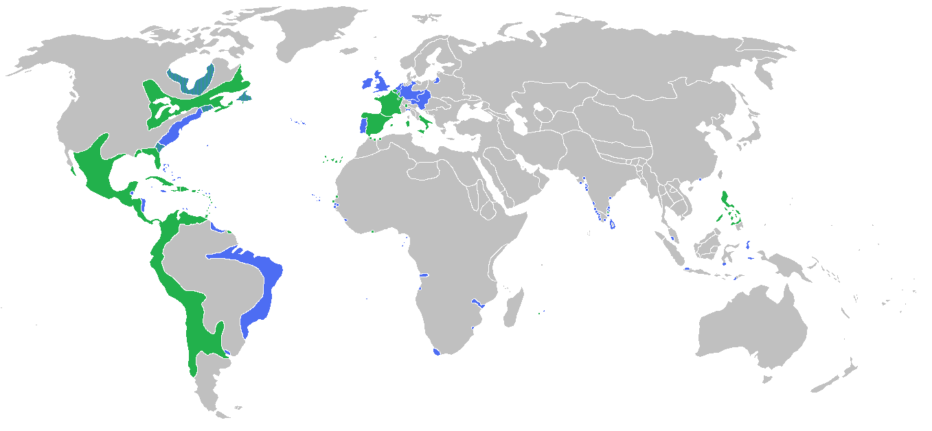
English: Locator map of the competing sides of the War of the Spanish Succession. Blue: Great Britain, Dutch Republic, Portugal with more. Green: Spain, France with more. |
| วันที่ | |
| แหล่งที่มา | งานของตัว |
| ผู้สร้างสรรค์ | Gabagool |
การอนุญาตใช้สิทธิ
ข้าพเจ้า ในฐานะผู้ถือลิขสิทธิ์ของภาพหรือสื่อนี้ อนุญาตให้ใช้ภาพหรือสื่อนี้ภายใต้เงื่อนไขต่อไปนี้
ไฟล์นี้อยู่ภายใต้สัญญาอนุญาตครีเอทีฟคอมมอนส์ รุ่น แสดงที่มา 3.0 ต้นฉบับ
- คุณสามารถ:
- ที่จะแบ่งปัน – ที่จะทำสำเนา แจกจ่าย และส่งงานดังกล่าวต่อไป
- ที่จะเรียบเรียงใหม่ – ที่จะดัดแปลงงานดังกล่าว
- ภายใต้เงื่อนไขต่อไปนี้:
- แสดงที่มา – คุณต้องให้เกียรติเจ้าของงานอย่างเหมาะสม โดยเพิ่มลิงก์ไปยังสัญญาอนุญาต และระบุหากมีการเปลี่ยนแปลง คุณอาจทำเช่นนี้ได้ในรูปแบบใดก็ได้ตามควร แต่ต้องไม่ใช่ในลักษณะที่แนะว่าผู้ให้อนุญาตสนับสนุนคุณหรือการใช้งานของคุณ
ประวัติไฟล์
คลิกวันที่/เวลาเพื่อดูไฟล์ที่ปรากฏในขณะนั้น
| วันที่/เวลา | รูปย่อ | ขนาด | ผู้ใช้ | ความเห็น | |
|---|---|---|---|---|---|
| ปัจจุบัน | 20:56, 13 พฤษภาคม 2553 | | 1,357 × 628 (51 กิโลไบต์) | Kieran4 | Borders for Dutch East Indies corrected |
| 08:35, 26 มีนาคม 2553 |  | 1,357 × 628 (51 กิโลไบต์) | Gabagool | some further adjustments | |
| 11:29, 20 มีนาคม 2553 |  | 1,357 × 628 (51 กิโลไบต์) | Gabagool | some corrections (NA) after notice and help by User:Magicpiano | |
| 05:32, 14 มิถุนายน 2552 |  | 1,357 × 628 (44 กิโลไบต์) | Gabagool | {{Information |Description={{en|1=Locator map of the competing sides of the War of the Spanish Succession.<br> Blue: Great Britain, Dutch Republic, Portugal with more. Green: Spain, France with more.<br> (Partially based on ''Atlas of World History'' (200 |
หน้าที่มีภาพนี้
หน้าต่อไปนี้ โยงมาที่ภาพนี้:
การใช้ไฟล์ข้ามโครงการ
วิกิอื่นต่อไปนี้ใช้ไฟล์นี้:
- การใช้บน el.wikipedia.org
- การใช้บน en.wikipedia.org
- การใช้บน fa.wikipedia.org
- การใช้บน fr.wikipedia.org
- การใช้บน hy.wikipedia.org
- การใช้บน ko.wikipedia.org
- การใช้บน lt.wikipedia.org
- การใช้บน pl.wikipedia.org
- การใช้บน uz.wikipedia.org
- การใช้บน vi.wikipedia.org