
ไฟล์:Position of Auckland Region.png
ไม่มีภาพที่มีรายละเอียดสูงกว่านี้
Position_of_Auckland_Region.png (405 × 590 พิกเซล, ขนาดไฟล์: 7 กิโลไบต์, ชนิดไมม์: image/png)
| รูปภาพหรือไฟล์เสียงนี้ ต้นฉบับอยู่ที่ คอมมอนส์ รายละเอียดด้านล่าง เป็นข้อความที่แสดงผลจาก ไฟล์ต้นฉบับในคอมมอนส์
|
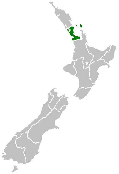
Region of New Zealand, position on the map (source:English Wiki)
| |
งานนี้ได้ถูกเผยแพร่สู่สาธารณสมบัติโดยเจ้าของ Furius จากวิกิพีเดีย ซึ่งมีผลทั่วโลก ในกรณีที่กฎหมายไม่อนุญาตให้ทำเช่นนั้น: |
ประวัติไฟล์
คลิกวันที่/เวลาเพื่อดูไฟล์ที่ปรากฏในขณะนั้น
| วันที่/เวลา | รูปย่อ | ขนาด | ผู้ใช้ | ความเห็น | |
|---|---|---|---|---|---|
| ปัจจุบัน | 14:40, 27 เมษายน 2548 | | 405 × 590 (7 กิโลไบต์) | Domie~commonswiki | Region of New Zealand, position on the map (source:English Wiki) {{PD}} Category:Maps of New Zealand |
หน้าที่มีภาพนี้
ไม่มีหน้าใดโยงมาที่ภาพนี้
การใช้ไฟล์ข้ามโครงการ
วิกิอื่นต่อไปนี้ใช้ไฟล์นี้:
- การใช้บน ceb.wikipedia.org
- การใช้บน en.wikipedia.org
- Dragon Island
- Colville Channel
- Jellicoe Channel
- Cradock Channel
- Ponui Island
- Anawhata
- Matiatia
- Stockade Hill
- Southdown, New Zealand
- Blackpool, New Zealand
- Waitemata City
- Aiguilles Island
- Te Ārai
- Pakatoa Island
- Papakura City
- Template:Auckland-geo-stub
- Churchill Park, New Zealand
- Mathesons Bay
- Watchman Island
- Windy Canyon
- Mount Hobson (Great Barrier Island)
- Ōhinerau / Mount Hobson
- Lower Nihotupu Reservoir
- Onepoto (volcanic crater)
- Bike Auckland
- Woodcocks, New Zealand
- Tarahiki Island
- Ahuroa
- Tomarata
- Umupuia Beach
- Long Bay Regional Park
- Cosseys Reservoir
- Moturekareka Island
- Papakura Military Camp
- Keri Hill
- Traherne Island
- Franklin County, New Zealand
- Rodney County, New Zealand
- Crater Hill
- Matukutūruru
- Mount Cambria
- Ash Hill, New Zealand
- Ōtāhuhu / Mount Richmond
- Pukaki Lagoon
- Pukeiti (Auckland)
- Te Pou Hawaiki
- Duders Hill
- Mount Saint John (New Zealand)
- Lake Rototoa
ดูการใช้ข้ามโครงการเพิ่มเติมของไฟล์นี้