
ไฟล์:Chicago locator map.png

ขนาดของตัวอย่างนี้: 570 × 600 พิกเซล ความละเอียดอื่น: 228 × 240 พิกเซล | 615 × 647 พิกเซล
ดูภาพที่มีความละเอียดสูงกว่า (615 × 647 พิกเซล, ขนาดไฟล์: 406 กิโลไบต์, ชนิดไมม์: image/png)
| รูปภาพหรือไฟล์เสียงนี้ ต้นฉบับอยู่ที่ คอมมอนส์ รายละเอียดด้านล่าง เป็นข้อความที่แสดงผลจาก ไฟล์ต้นฉบับในคอมมอนส์
|
ความย่อ
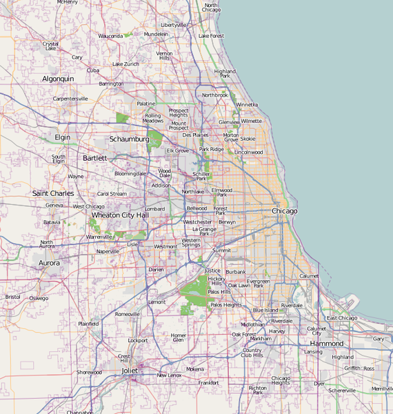
| คำอธิบาย | A map of Chicago, IL, and the surrounding area |
| วันที่ | |
| แหล่งที่มา | Base map generated by OpenStreetMap.org |
| ผู้สร้างสรรค์ | Dudemanfellabra |
| การอนุญาต (การใช้ไฟล์นี้ใหม่) |
OpenStreetMap license |
| เวอร์ชันอื่น | ไฟล์อื่นที่ใช้ไฟล์นี้: Chicago map LSD.png |

|
ภาพแผนที่นครนี้ ควรจะถูกสร้างใหม่เป็นกราฟิกส์เวกเตอร์ ซึ่งมีข้อดีอีกหลายประการ ดูเพิ่มเติมที่คอมมอนส์:สื่อต้องการเก็บกวาดสำหรับสารสนเทศเพิ่มเติม หากภาพนี้มีในรูปแบบกราฟิกส์เวกเตอร์อยู่แล้ว กรุณาอัปโหลดและแทนที่แม่แบบนี้ด้วย
{{vector version available|ชื่อภาพใหม่}}
แนะนำเป็นอย่างยิ่งให้ตั้งชื่อไฟล์เวกเตอร์ใหม่นั้นในรูปแบบ "Chicago locator map.svg" แล้วใส่แม่แบบ Vector version available (หรือ Vva) ซึ่งไม่ต้องใช้พารามิเตอร์ ชื่อภาพใหม่ |
การอนุญาตใช้สิทธิ
ไฟล์นี้อยู่ภายใต้สัญญาอนุญาต ครีเอทีฟคอมมอนส์ แบบแสดงที่มา-อนุญาตแบบเดียวกัน 2.0 ทั่วไป
- คุณสามารถ:
- ที่จะแบ่งปัน – ที่จะทำสำเนา แจกจ่าย และส่งงานดังกล่าวต่อไป
- ที่จะเรียบเรียงใหม่ – ที่จะดัดแปลงงานดังกล่าว
- ภายใต้เงื่อนไขต่อไปนี้:
- แสดงที่มา – คุณต้องให้เกียรติเจ้าของงานอย่างเหมาะสม โดยเพิ่มลิงก์ไปยังสัญญาอนุญาต และระบุหากมีการเปลี่ยนแปลง คุณอาจทำเช่นนี้ได้ในรูปแบบใดก็ได้ตามควร แต่ต้องไม่ใช่ในลักษณะที่แนะว่าผู้ให้อนุญาตสนับสนุนคุณหรือการใช้งานของคุณ
- อนุญาตแบบเดียวกัน – หากคุณดัดแปลง เปลี่ยนรูป หรือต่อเติมงานนี้ คุณต้องใช้สัญญาอนุญาตแบบเดียวกันหรือแบบที่เหมือนกับสัญญาอนุญาตที่ใช้กับงานนี้เท่านั้น
ประวัติไฟล์
คลิกวันที่/เวลาเพื่อดูไฟล์ที่ปรากฏในขณะนั้น
| วันที่/เวลา | รูปย่อ | ขนาด | ผู้ใช้ | ความเห็น | |
|---|---|---|---|---|---|
| ปัจจุบัน | 01:00, 28 กุมภาพันธ์ 2560 | | 615 × 647 (406 กิโลไบต์) | Jeanjung212 | Lossless Compressed/optimized png decreasing file size by 59696 bytes |
| 05:49, 6 มกราคม 2553 |  | 615 × 647 (464 กิโลไบต์) | Dudemanfellabra | {{Information |Description={{en|1=A map of Chicago, IL, and the surrounding area}} |Source={{own}} |Author=Dudemanfellabra |Date=2010-01-05 |Permission= |other_versions= }} Category:Maps of Chicago |
หน้าที่มีภาพนี้
หน้าต่อไปนี้ โยงมาที่ภาพนี้:
การใช้ไฟล์ข้ามโครงการ
วิกิอื่นต่อไปนี้ใช้ไฟล์นี้:
- การใช้บน af.wikipedia.org
- การใช้บน ar.wikipedia.org
- การใช้บน bn.wikipedia.org
- การใช้บน ceb.wikipedia.org
- การใช้บน en.wikipedia.org
- Fort Dearborn
- John Hancock Center
- Aon Center (Chicago)
- Saint Valentine's Day Massacre
- Navy Pier
- Alsip, Illinois
- Bartlett, Illinois
- Buffalo Grove, Illinois
- Elgin, Illinois
- Hoffman Estates, Illinois
- Olympia Fields, Illinois
- Aurora, Illinois
- Bolingbrook, Illinois
- Carol Stream, Illinois
- Naperville, Illinois
- Carpentersville, Illinois
- Joliet, Illinois
- Lake Forest, Illinois
- German submarine U-505
- Northwestern University
- Field Museum of Natural History
- Symphony Center
- Garfield Park (Chicago)
- Robie House
- Mundelein College
- SeatGeek Stadium
- Willits House
- Graceland Cemetery
- Maine North High School
- Two Prudential Plaza
- 900 North Michigan
- Chase Tower (Chicago)
- Park Tower (Chicago)
- The Palmer House Hilton
- Rosehill Cemetery
- St. Ignatius College Prep
- Bryn Mawr Historic District
- Edgewater Beach Hotel
- The Levee, Chicago
- Palmer Park (Chicago)
- 330 North Wabash
ดูการใช้ข้ามโครงการเพิ่มเติมของไฟล์นี้