ผลต่างระหว่างรุ่นของ "แม่แบบ:Location map Somalia"
เนื้อหาที่ลบ เนื้อหาที่เพิ่ม
ล โรบอต ลบ: tr:Şablon:Location map Somalia (strong connection between (2) th:แม่แบบ:Location map Somalia and tr:Şablon:Somali konum haritası) ป้ายระบุ: ลบลิงก์ข้ามภาษา |
ลไม่มีความย่อการแก้ไข |
||
| บรรทัด 5: | บรรทัด 5: | ||
| left = 40.5 |
| left = 40.5 |
||
| right = 51.9 |
| right = 51.9 |
||
| image = Somalia location map.svg |
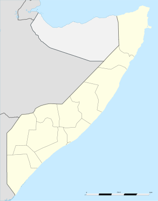
| image = Somalia location map (2).svg |
||
}}<noinclude>{{Location map/Info}} |
}}<noinclude>{{Location map/Info}} |
||
รุ่นแก้ไขปัจจุบันเมื่อ 01:50, 18 มกราคม 2564
| name | Somalia | |||
|---|---|---|---|---|
| border coordinates | ||||
| 12.4 | ||||
| 40.5 | ←↕→ | 51.9 | ||
| -2.05 | ||||
| map center | 5°10′30″N 46°12′00″E / 5.175°N 46.2°E | |||
| image | Somalia location map (2).svg | |||

| ||||
Alternative maps[แก้]
The AlternativeMap parameter in Template:Location map can be used to display the following alternative map image:

