ผลต่างระหว่างรุ่นของ "จังหวัดกาลีมันตันใต้"
เนื้อหาที่ลบ เนื้อหาที่เพิ่ม
หน้าใหม่: {{Infobox settlement | name = จังหวัดกาลีมันตันใต้ | native_name = {{nobold|''Kalimantan Selatan''... |
ลไม่มีความย่อการแก้ไข |
||
| บรรทัด 17: | บรรทัด 17: | ||
| border = 1 |
| border = 1 |
||
}} |
}} |
||
| image_caption = |
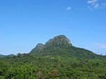
| image_caption = ซ้ายบน ซ้ายไปขวา : Pulau Kembang, Floating market in Banjarmasin, Loksado Hill, [[Martapura River]], Proclamation Monument, Tanjung Dewa, Mount Halau-Halau |
||
| image_seal = Lambang Provinsi Kalimantan Selatan.gif |
| image_seal = Lambang Provinsi Kalimantan Selatan.gif |
||
| image_flag = Flag of South Kalimantan.png |
| image_flag = Flag of South Kalimantan.png |
||
| บรรทัด 24: | บรรทัด 24: | ||
| image_map = IndonesiaSouthKalimantan.png |
| image_map = IndonesiaSouthKalimantan.png |
||
| map_alt = |
| map_alt = |
||
| map_caption = สถานที่ตั้งของจังหวัดกาลีมันตันใต้ในอินโดนีเซีย |
|||
| map_caption = Location of South Kalimantan in Indonesia |
|||
| coordinates = {{coord|2|30|S|115|30|E|region:ID_type:adm1st|display=inline,title}} |
| coordinates = {{coord|2|30|S|115|30|E|region:ID_type:adm1st|display=inline,title}} |
||
| coor_pinpoint = |
| coor_pinpoint = |
||
| บรรทัด 54: | บรรทัด 54: | ||
| demographics_type1 = Demographics |
| demographics_type1 = Demographics |
||
| demographics1_footnotes = <!-- for references: use <ref> tags --> |
| demographics1_footnotes = <!-- for references: use <ref> tags --> |
||
| |
| demographics1_title1 = [[Ethnic groups|กลุ่มชาติพันธุ์]] |
||
| timezone1 = [[Time in Indonesia|Indonesia Central Time]] |
| timezone1 = [[Time in Indonesia|Indonesia Central Time]] |
||
| utc_offset1 = +8 |
| utc_offset1 = +8 |
||
รุ่นแก้ไขเมื่อ 17:15, 13 พฤศจิกายน 2561
จังหวัดกาลีมันตันใต้ Kalimantan Selatan | |
|---|---|
| การถอดเสียงOther | |
| • Jawi | کاليمانتان سلاتن |
| • Banjarese | Kalimantan Salatan |
ซ้ายบน ซ้ายไปขวา : Pulau Kembang, Floating market in Banjarmasin, Loksado Hill, Martapura River, Proclamation Monument, Tanjung Dewa, Mount Halau-Halau | |
| คำขวัญ: Haram Manyarah Waja Sampai Kaputing (Banjarese) (Never Surrender, Strong As Steel Until The End) | |
 สถานที่ตั้งของจังหวัดกาลีมันตันใต้ในอินโดนีเซีย | |
| พิกัด: 2°30′S 115°30′E / 2.500°S 115.500°E | |
| ประเทศ | |
| ก่อตั้ง | 14 สิงหาคม 1950 |
| เมืองหลวง | |
| การปกครอง | |
| • องค์กร | South Kalimantan Regional Government |
| • Governor | H. Sahbirin Noor |
| • Vice Governor | Rudy Resnawan |
| พื้นที่ | |
| • ทั้งหมด | 38,744.23 ตร.กม. (14,959.23 ตร.ไมล์) |
| อันดับพื้นที่ | 19th |
| ความสูงจุดสูงสุด | 1,901 เมตร (6,237 ฟุต) |
| ประชากร (2014)[1] | |
| • ทั้งหมด | 3,913,908 คน |
| • อันดับ | 17th |
| • ความหนาแน่น | 100 คน/ตร.กม. (260 คน/ตร.ไมล์) |
| Demographics | |
| • กลุ่มชาติพันธุ์ | Banjarese (76%), Javanese (13%)[2] |
| • ภาษา | Indonesian (official), Banjarese |
| เขตเวลา | UTC+8 (Indonesia Central Time) |
| Postcodes | 70xxx, 71xxx, 72xxx |
| Area codes | (62)5xx |
| รหัส ISO 3166 | ID-KS |
| Vehicle sign | DA |
| HDI | |
| HDI rank | 21st (2014) |
| Largest city by area | Banjarbaru - 371.00 ตารางกิโลเมตร (143.24 ตารางไมล์) |
| Largest city by population | Banjarmasin - (625,481 - 2010) |
| Largest regency by area | Kotabaru Regency - 9,482.73 ตารางกิโลเมตร (3,661.30 ตารางไมล์) |
| Largest regency by population | Banjar Regency - (506,839 - 2010) |
| เว็บไซต์ | Government official site |
| = | |
จังหวัดกาลีมันตันใต้ (อินโดนีเซีย: Kalimantan Selatan) เป็นจังหวัดของประเทศอินโดนีเซีย ตั้งอยู่ในกาลีมันตัน ดินแดนของประเทศอินโดนีเซียบนเกาะบอร์เนียว เมืองหลวงของจังหวัดคือ บันจาร์มาซิน ประชากรของจังหวัดกาลีมันตันใต้มีมากกว่า 3.625 ล้านคน จากการสำรวจสำมะโนประชากรปี ค.ศ. 2010[1] และข้อมูลทางการล่าสุดในเดือนมกราคม 2014 มีประชากร 3,913,908 คน
จังหวัดกาลีมันตันใต้เป็นหนึ่งในห้าจังหวัดของอินโดนีเซียในกาลีมันตัน อยู่ติดกับช่องแคบมากัซซาร์ทางทิศตะวันออก ติดกับจังหวัดกาลีมันตันกลางทางทิศตะวันตกและเหนือ ติดกับทะเลชวาทางทิศใต้ และติดกับจังหวัดกาลีมันตันตะวันออกทางทิศเหนือ
อ้างอิง
- ↑ 1.0 1.1 Central Bureau of Statistics: Census 2010 เก็บถาวร 2010-11-13 ที่ เวย์แบ็กแมชชีน, retrieved 17 January 2011 (อินโดนีเซีย)
- ↑ "INDONESIA: Population and Administrative Divisions" (PDF). The Permanent Committee on Geographical Names. 2003.


