ผลต่างระหว่างรุ่นของ "จังหวัดชวากลาง"
เนื้อหาที่ลบ เนื้อหาที่เพิ่ม
ล แทนที่ ‘(?mi)\{\{Link FA\|.+?\}\}\n?’ ด้วย ‘’: เลิกใช้ เปลี่ยนไปใช้วิกิสนเทศ |
ไม่มีความย่อการแก้ไข ป้ายระบุ: แก้ไขจากอุปกรณ์เคลื่อนที่ แก้ไขจากเว็บสำหรับอุปกรณ์เคลื่อนที่ |
||
| บรรทัด 1: | บรรทัด 1: | ||
{{Infobox settlement |
|||
| name = ชวากลาง |
|||
| native_name = {{lang|id|Jawa Tengah}}<br> {{lang|jv|ꦗꦮꦠꦼꦔꦃ}} |
|||
| native_name_lang = |
|||
| image_skyline = {{Photomontage |
|||
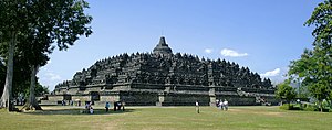
| photo1a = Borobudur-Nothwest-view.jpg |
|||
| photo2a = Merbabu&Merapi.JPG |
|||
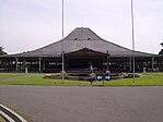
| photo2b = Pura Mangkunagaran01(2 Maret 2007).jpg |
|||
| photo3a = Fishermen on Rawa Pening.jpg |
|||
| photo3b = Dieng Plateau Java140.jpg |
|||
| photo4a = Ujung Gelam Beach Karimun Jawa 3.JPG |
|||
| photo4b = Serayu River, Central Java.jpg |
|||
| size = 300 |
|||
| spacing = 1 |
|||
| color = white |
|||
| border = 1 |
|||
}} |
|||
| image_alt = |
|||
| image_caption = Clockwise, from top left : [[Borobudur]], [[Mangkunegaran Palace]], Village in the [[Dieng Plateau]], [[Serayu River]], [[Karimunjava]], Fishermen on [[Lake Rawa Pening|Rawa Pening]], Rice paddy with [[Mount Merapi]] and [[Mount Merbabu]] in the background |
|||
| image_seal = Central Java COA.svg |
|||
| seal_alt = |
|||
| nickname = |
|||
| motto = {{lang-jv|ꦥꦿꦱꦺꦠꦾꦈꦭꦃꦱꦏ꧀ꦠꦶꦨꦏ꧀ꦠꦶꦥꦿꦗ}}<br>{{lang-en|A vow of devotion with all might to the country}} |
|||
| image_map = IndonesiaCentralJava.png |
|||
| map_alt = |
|||
| map_caption = Location of Central Java in Indonesia |
|||
| coordinates = {{coord|7|30|S|110|00|E|region:ID_type:adm1st|display=inline,title}} |
|||
| coor_pinpoint = |
|||
| coordinates_footnotes = |
|||
| subdivision_type = ประเทศ |
|||
| subdivision_name = {{flag|Indonesia}} |
|||
| established_title = Established |
|||
| established_date = August 15, 1950 |
|||
| founder = |
|||
| named_for = |
|||
| seat_type = เมืองเอก |
|||
| seat = [[เซอมารัง]] |
|||
| government_footnotes = |
|||
| governing_body = Central Java Regional Government |
|||
| leader_party = |
|||
| leader_title = ผู้ว่าราชการ |
|||
| leader_name = [[Ganjar Pranowo]] |
|||
| unit_pref = Metric<!-- or US or UK --> |
|||
| area_footnotes = |
|||
| area_total_km2 = 32800.69 |
|||
| area_note = |
|||
| elevation_footnotes = |
|||
| elevation_m = |
|||
| population_total = 33753023 |
|||
| population_as_of = 2557 |
|||
| population_footnotes = |
|||
| population_density_km2 = auto |
|||
| population_rank = 3rd |
|||
| population_note = |
|||
| demographics_type1 = Demographics |
|||
| demographics1_footnotes = <!-- for references: use <ref> tags --> |
|||
| demographics1_title1 = [[Ethnic groups]] |
|||
| timezone1 = ICT |
|||
| utc_offset1 = +7 |
|||
| postal_code_type = [[Postal codes in Indonesia|Postcodes]] |
|||
| postal_code = 50xxx, 51xxx, 52xxx |
|||
| area_code = (+62) 2xx |
|||
| area_code_type = [[Telephone numbers in Indonesia|Area codes]] |
|||
| geocode = |
|||
| iso_code = ID-JT |
|||
| registration_plate = [[Vehicle registration plates of Indonesia|AA, AD, K, G, H]] |
|||
| blank_name_sec1 = GRP per capita |
|||
| blank_info_sec1 = US$ 2,326 |
|||
| blank1_name_sec1 = GRP rank |
|||
| blank1_info_sec1 = [[List of Indonesian provinces by GRP per capita|25th]] |
|||
| blank_name_sec2 = Largest city by area |
|||
| blank_info_sec2 = Semarang - {{convert|373.78|km2|sqmi}} |
|||
| blank1_name_sec2 = Largest city by population |
|||
| blank1_info_sec2 = Semarang - (1,555,984 - 2010) |
|||
| website = {{URL|jatengprov.go.id|Government official site}} |
|||
| footnotes = |
|||
| type = จังหวัด |
|||
| leader_title2 = Vice Governor |
|||
| leader_name2 = [[Heru Sudjatmoko|Heru Sudjatmoko]] |
|||
| elevation_max_m = 3428 |
|||
| demographics1_info1 = [[Javanese people|Javanese]] (98%), [[Sundanese people|Sundanese]] (1%), [[Chinese Indonesian|Chinese]] (1%) |
|||
| demographics1_title2 = [[Religion]] |
|||
| demographics1_info2 = [[Islam]] 95.74%, [[Christianity]] 4.95%, [[Hinduism]] 0.05%, [[Buddhism]] 0.22%, [[Confucianism]] 0.03%, and [[Kejawen]] |
|||
| demographics1_title3 = [[ภาษา]] |
|||
| demographics1_info3 = [[ภาษาอินโดนีเซีย]] (official)<br>[[ภาษาชวา]] (native)<br>[[Banyumasan dialect|Banyumasan]] (regional)<br>[[Kedu dialect|Kedu]] (regional)<br>[[Sundanese language|Sundanese]] (regional) |
|||
| registration_plate_type = [[Vehicle registration plates of Indonesia|Vehicle sign]] |
|||
| blank2_name_sec1 = [[Human Development Index|HDI]] |
|||
| blank2_info_sec1 = {{increase}} 0.700({{fontcolor|Darkgreen|High}}) |
|||
| blank3_name_sec1 = HDI rank |
|||
| blank3_info_sec1 = [[List of Indonesian provinces by Human Development Index|12th]] |
|||
| blank2_name_sec2 = Largest regency by area |
|||
| blank2_info_sec2 = [[Cilacap Regency]] - {{convert|2124.47|km2|sqmi}} |
|||
| blank3_name_sec2 = Largest regency by population |
|||
| blank3_info_sec2 = [[Brebes Regency]] - (1,733,869 - 2010) |
|||
}} |
|||
'''ชวากลาง''' ({{lang-id|Jawa Tengah}}) เป็นจังหวัดหนึ่งของ[[ประเทศอินโดนีเซีย]] เมืองเอกคือ [[เซอมารัง]] (Semarang) นับเป็นหนึ่งในจังหวัดทั้งหกของ[[เกาะชวา]] ชวากลางมีจุดเด่นทั้งด้านวัฒนธรรม และทางการเมือง [[ยอกยาการ์ตา]]เป็นส่วนสำคัญแห่งหนึ่งของชวากลาง อย่างไรก็ตาม ในเชิงการบริหารแล้ว เมืองนี้และพื้นที่โดยรอบเป็นพื้นที่พิเศษที่แยกต่างหาก นับตั้งแต่อินโดนีเซียประกาศเอกราช |
'''ชวากลาง''' ({{lang-id|Jawa Tengah}}) เป็นจังหวัดหนึ่งของ[[ประเทศอินโดนีเซีย]] เมืองเอกคือ [[เซอมารัง]] (Semarang) นับเป็นหนึ่งในจังหวัดทั้งหกของ[[เกาะชวา]] ชวากลางมีจุดเด่นทั้งด้านวัฒนธรรม และทางการเมือง [[ยอกยาการ์ตา]]เป็นส่วนสำคัญแห่งหนึ่งของชวากลาง อย่างไรก็ตาม ในเชิงการบริหารแล้ว เมืองนี้และพื้นที่โดยรอบเป็นพื้นที่พิเศษที่แยกต่างหาก นับตั้งแต่อินโดนีเซียประกาศเอกราช |
||
รุ่นแก้ไขเมื่อ 04:51, 6 พฤศจิกายน 2560
ชวากลาง Jawa Tengah ꦗꦮꦠꦼꦔꦃ | |
|---|---|
จังหวัด | |
Clockwise, from top left : Borobudur, Mangkunegaran Palace, Village in the Dieng Plateau, Serayu River, Karimunjava, Fishermen on Rawa Pening, Rice paddy with Mount Merapi and Mount Merbabu in the background | |
| คำขวัญ: | |
 Location of Central Java in Indonesia | |
| พิกัด: 7°30′S 110°00′E / 7.500°S 110.000°E | |
| ประเทศ | |
| Established | August 15, 1950 |
| เมืองเอก | เซอมารัง |
| การปกครอง | |
| • องค์กร | Central Java Regional Government |
| • ผู้ว่าราชการ | Ganjar Pranowo |
| • Vice Governor | Heru Sudjatmoko |
| พื้นที่ | |
| • ทั้งหมด | 32,800.69 ตร.กม. (12,664.42 ตร.ไมล์) |
| ความสูงจุดสูงสุด | 3,428 เมตร (11,247 ฟุต) |
| ประชากร (2557) | |
| • ทั้งหมด | 33,753,023 คน |
| • อันดับ | 3rd |
| • ความหนาแน่น | 1,000 คน/ตร.กม. (2,700 คน/ตร.ไมล์) |
| Demographics | |
| • Ethnic groups | Javanese (98%), Sundanese (1%), Chinese (1%) |
| • Religion | Islam 95.74%, Christianity 4.95%, Hinduism 0.05%, Buddhism 0.22%, Confucianism 0.03%, and Kejawen |
| • ภาษา | ภาษาอินโดนีเซีย (official) ภาษาชวา (native) Banyumasan (regional) Kedu (regional) Sundanese (regional) |
| เขตเวลา | UTC+7 (ICT) |
| Postcodes | 50xxx, 51xxx, 52xxx |
| Area codes | (+62) 2xx |
| รหัส ISO 3166 | ID-JT |
| Vehicle sign | AA, AD, K, G, H |
| GRP per capita | US$ 2,326 |
| GRP rank | 25th |
| HDI | |
| HDI rank | 12th |
| Largest city by area | Semarang - 373.78 ตารางกิโลเมตร (144.32 ตารางไมล์) |
| Largest city by population | Semarang - (1,555,984 - 2010) |
| Largest regency by area | Cilacap Regency - 2,124.47 ตารางกิโลเมตร (820.26 ตารางไมล์) |
| Largest regency by population | Brebes Regency - (1,733,869 - 2010) |
| เว็บไซต์ | Government official site |
ชวากลาง (อินโดนีเซีย: Jawa Tengah) เป็นจังหวัดหนึ่งของประเทศอินโดนีเซีย เมืองเอกคือ เซอมารัง (Semarang) นับเป็นหนึ่งในจังหวัดทั้งหกของเกาะชวา ชวากลางมีจุดเด่นทั้งด้านวัฒนธรรม และทางการเมือง ยอกยาการ์ตาเป็นส่วนสำคัญแห่งหนึ่งของชวากลาง อย่างไรก็ตาม ในเชิงการบริหารแล้ว เมืองนี้และพื้นที่โดยรอบเป็นพื้นที่พิเศษที่แยกต่างหาก นับตั้งแต่อินโดนีเซียประกาศเอกราช
จังหวัดชวากลางมีพื้นที่ 32,548.20 ตารางกิโลเมตร หรือประมาณหนึ่งในสี่ของพื้นที่เกาะชวา มีประชากร 31,820,000 ( พ.ศ. 2548) จึงเป็นจังหวัดที่มีประชากรมากเป็นอันดับสามของอินโดนีเซีย รองจากชวาตะวันตก และชวาตะวันออก และมีประชากรประมาณหนึ่งในสี่ของเกาะนี้
7°30′S 110°00′E / 7.500°S 110.000°E{{#coordinates:}}: ไม่สามารถมีป้ายกำกับหลักมากกว่าหนึ่งป้ายต่อหน้าได้


