
ไฟล์:USA 09669 Taos Pueblo Luca Galuzzi 2007.jpg
ดูภาพที่มีความละเอียดสูงกว่า (2,000 × 1,333 พิกเซล, ขนาดไฟล์: 2.37 เมกะไบต์, ชนิดไมม์: image/jpeg)
| รูปภาพหรือไฟล์เสียงนี้ ต้นฉบับอยู่ที่ คอมมอนส์ รายละเอียดด้านล่าง เป็นข้อความที่แสดงผลจาก ไฟล์ต้นฉบับในคอมมอนส์
|
|
This is an image of a place or building that is listed on the National Register of Historic Places in the United States of America. Its reference number is 66000496. |
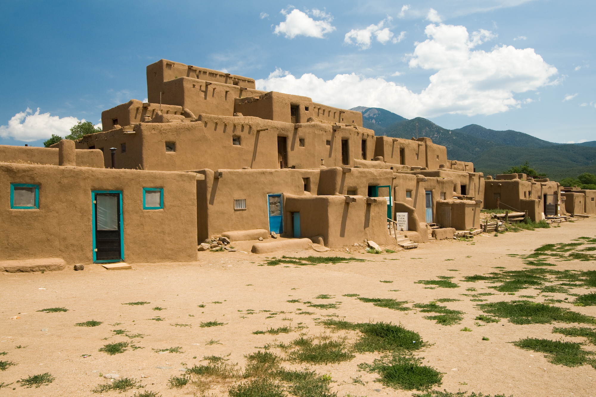
| คำอธิบาย | Taos Pueblo multi-storied residential complex of reddish-brown adobe. It was probably built between 1000 and 1450 A.D. Located about 1 mile (1.6 km) north of the modern city of Taos, New Mexico, USA. | ||
| วันที่ | |||
| แหล่งที่มา | Photo taken by (Luca Galuzzi) * http://www.galuzzi.it | ||
| ผู้สร้างสรรค์ | Luca Galuzzi (Lucag) | ||
| การอนุญาต (การใช้ไฟล์นี้ใหม่) |
I, Luca Galuzzi ในฐานะผู้ถือลิขสิทธิ์ของภาพหรือสื่อนี้ อนุญาตให้ใช้ภาพหรือสื่อนี้ภายใต้เงื่อนไขต่อไปนี้ ไฟล์นี้อยู่ภายใต้สัญญาอนุญาต ครีเอทีฟคอมมอนส์ แบบแสดงที่มา-อนุญาตแบบเดียวกัน 2.5 ทั่วไป การแสดงที่มา: I, Luca Galuzzi
|

| ตำแหน่งของวัตถุหรือสถานที่ | | ภาพนี้และภาพอื่น ๆ ณ สถานที่เดียวกันที่ OpenStreetMap |
|---|
ประวัติไฟล์
คลิกวันที่/เวลาเพื่อดูไฟล์ที่ปรากฏในขณะนั้น
| วันที่/เวลา | รูปย่อ | ขนาด | ผู้ใช้ | ความเห็น | |
|---|---|---|---|---|---|
| ปัจจุบัน | 04:05, 6 กันยายน 2550 | | 2,000 × 1,333 (2.37 เมกะไบต์) | Lucag | {{Information |Description=Taos Pueblo multi-storied residential complex of reddish-brown adobe. It was probably built between 1000 and 1450 A.D. Located about 1 mile (1.6 km) north of the modern city of Taos, New Mexico, USA. |Source=Photo taken by ([[Us |
หน้าที่มีภาพนี้
หน้าต่อไปนี้ โยงมาที่ภาพนี้:
การใช้ไฟล์ข้ามโครงการ
วิกิอื่นต่อไปนี้ใช้ไฟล์นี้:
- การใช้บน af.wikipedia.org
- การใช้บน ast.wikipedia.org
- การใช้บน bat-smg.wikipedia.org
- การใช้บน be.wikipedia.org
- การใช้บน bn.wikipedia.org
- การใช้บน ca.wikipedia.org
- การใช้บน de.wikipedia.org
- การใช้บน de.wikibooks.org
- การใช้บน de.wikivoyage.org
- การใช้บน en.wikipedia.org
- Colorado Western Slope
- Pueblo Revolt
- List of National Historic Landmarks in New Mexico
- National Register of Historic Places listings in Taos County, New Mexico
- Prehistory of Colorado
- Chamuscado and Rodríguez Expedition
- Mountain states
- List of Ancestral Puebloan dwellings in Colorado
- List of Ancestral Puebloan dwellings in New Mexico
- Pueblo I Period
- Pueblo II Period
- Pueblo III Period
- Pueblo IV Period
- Basketmaker III Era
- Late Basketmaker II Era
- Early Basketmaker II Era
- Basketmaker culture
- Pueblo V Period
- Archaic–Early Basketmaker Era
- Template:Ancestral Puebloan Periods
- List of World Heritage Sites in North America
- Ancestral Puebloans
- การใช้บน en.wikivoyage.org
- การใช้บน es.wikipedia.org
ดูการใช้ข้ามโครงการเพิ่มเติมของไฟล์นี้