
ไฟล์:USACE New Orleans skyline.jpg

ขนาดของตัวอย่างนี้: 800 × 534 พิกเซล ความละเอียดอื่น: 320 × 214 พิกเซล | 640 × 428 พิกเซล | 1,024 × 684 พิกเซล | 1,500 × 1,002 พิกเซล
ดูภาพที่มีความละเอียดสูงกว่า (1,500 × 1,002 พิกเซล, ขนาดไฟล์: 314 กิโลไบต์, ชนิดไมม์: image/jpeg)
| รูปภาพหรือไฟล์เสียงนี้ ต้นฉบับอยู่ที่ คอมมอนส์ รายละเอียดด้านล่าง เป็นข้อความที่แสดงผลจาก ไฟล์ต้นฉบับในคอมมอนส์
|
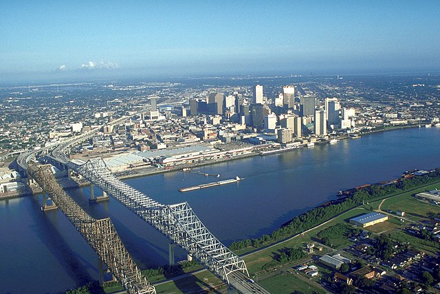
| คำอธิบาย | Skyline of New Orleans, Louisiana, USA. The twin spans of the Crescent City Connection bridges are in the foreground. | |||
| วันที่ | ||||
| แหล่งที่มา |
U.S. Army Corp of Engineers Digital Visual Library Digital Visual Library home page Image page Image description page |
|||
| ผู้สร้างสรรค์ | Michael Maples, U.S. Army Corps of Engineers | |||
| การอนุญาต (การใช้ไฟล์นี้ใหม่) |
|
|||
| เวอร์ชันอื่น |
|

| ตำแหน่งที่ตั้งกล้อง | | ภาพนี้และภาพอื่น ๆ ณ สถานที่เดียวกันที่ OpenStreetMap |
|---|
ประวัติไฟล์
คลิกวันที่/เวลาเพื่อดูไฟล์ที่ปรากฏในขณะนั้น
| วันที่/เวลา | รูปย่อ | ขนาด | ผู้ใช้ | ความเห็น | |
|---|---|---|---|---|---|
| ปัจจุบัน | 10:55, 14 มีนาคม 2550 | | 1,500 × 1,002 (314 กิโลไบต์) | DanMS | {{Information | Description = Skyline of New Orleans, Louisiana, USA. | Source = U.S. Army Corp of Engineers Digital Visual Library<br />[http://images.usace.army.mil/Main.html Digital Visual Library home page]<br />[http://images.usace.army.mil/imag |
หน้าที่มีภาพนี้
ไม่มีหน้าใดโยงมาที่ภาพนี้
การใช้ไฟล์ข้ามโครงการ
วิกิอื่นต่อไปนี้ใช้ไฟล์นี้:
- การใช้บน bg.wikipedia.org
- การใช้บน bn.wikipedia.org
- การใช้บน de.wikipedia.org
- การใช้บน en.wikipedia.org
- การใช้บน es.wikipedia.org
- การใช้บน es.wikinews.org
- การใช้บน ext.wikipedia.org
- การใช้บน fa.wikipedia.org
- การใช้บน fr.wikipedia.org
- การใช้บน it.wikiquote.org
- การใช้บน it.wikivoyage.org
- การใช้บน nl.wikipedia.org
- การใช้บน zh.wikipedia.org