
ไฟล์:Qatar municipalities map after 2004 reorganization english.svg

ขนาดของตัวอย่าง PNG นี้ของไฟล์ SVG นี้: 344 × 600 พิกเซล ความละเอียดอื่น: 137 × 240 พิกเซล | 275 × 480 พิกเซล | 440 × 768 พิกเซล | 587 × 1,024 พิกเซล | 1,175 × 2,048 พิกเซล | 459 × 800 พิกเซล
ดูภาพที่มีความละเอียดสูงกว่า ((ไฟล์ SVG, 459 × 800 พิกเซล, ขนาดไฟล์: 134 กิโลไบต์))
| รูปภาพหรือไฟล์เสียงนี้ ต้นฉบับอยู่ที่ คอมมอนส์ รายละเอียดด้านล่าง เป็นข้อความที่แสดงผลจาก ไฟล์ต้นฉบับในคอมมอนส์
|
ความย่อ
| คำอธิบาย |
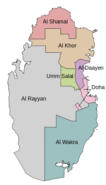
English: Map of the Qatar municipalities after the 2004 reorganization. In English. |
| วันที่ | |
| แหล่งที่มา | Self-made using OpenJUMP and Inkscape. Based on Explore Qatar GIS. |
| ผู้สร้างสรรค์ | Bamyers99 |
| เวอร์ชันอื่น |
|

การอนุญาตใช้สิทธิ
ข้าพเจ้า ในฐานะผู้ถือลิขสิทธิ์ของภาพหรือสื่อนี้ อนุญาตให้ใช้ภาพหรือสื่อนี้ภายใต้เงื่อนไขต่อไปนี้
| ไฟล์นี้มีให้ใช้ภายใต้ CC0 1.0 Universal Public Domain Dedication ของครีเอทีฟคอมมอนส์ | |
| The person who associated a work with this deed has dedicated the work to the public domain by waiving all of their rights to the work worldwide under copyright law, including all related and neighboring rights, to the extent allowed by law. You can copy, modify, distribute and perform the work, even for commercial purposes, all without asking permission.
|
ประวัติไฟล์
คลิกวันที่/เวลาเพื่อดูไฟล์ที่ปรากฏในขณะนั้น
| วันที่/เวลา | รูปย่อ | ขนาด | ผู้ใช้ | ความเห็น | |
|---|---|---|---|---|---|
| ปัจจุบัน | 04:43, 23 ธันวาคม 2554 | | 459 × 800 (134 กิโลไบต์) | Bamyers99 | {{Information |Description ={{en|1=Map of the Qatar municipalities after the 2004 reorganization. In English.}} |Source =Self-made using OpenJUMP and Inkscape. Based on [http://www.gisqatar.org.qa/ExploreEN/ Explore Qatar GIS]. |Author |
หน้าที่มีภาพนี้
ไม่มีหน้าใดโยงมาที่ภาพนี้
การใช้ไฟล์ข้ามโครงการ
วิกิอื่นต่อไปนี้ใช้ไฟล์นี้:
- การใช้บน ace.wikipedia.org
- การใช้บน az.wikipedia.org
- การใช้บน it.wikipedia.org
- การใช้บน lez.wikipedia.org
- การใช้บน mzn.wikipedia.org
- การใช้บน nn.wikipedia.org
- การใช้บน no.wikipedia.org
- การใช้บน uk.wikipedia.org
- การใช้บน xmf.wikipedia.org