
ไฟล์:Merseyside UK location map.svg

ขนาดของตัวอย่าง PNG นี้ของไฟล์ SVG นี้: 565 × 599 พิกเซล ความละเอียดอื่น: 226 × 240 พิกเซล | 453 × 480 พิกเซล | 724 × 768 พิกเซล | 966 × 1,024 พิกเซล | 1,932 × 2,048 พิกเซล | 1,231 × 1,305 พิกเซล
ดูภาพที่มีความละเอียดสูงกว่า ((ไฟล์ SVG, 1,231 × 1,305 พิกเซล, ขนาดไฟล์: 1.3 เมกะไบต์))
| รูปภาพหรือไฟล์เสียงนี้ ต้นฉบับอยู่ที่ คอมมอนส์ รายละเอียดด้านล่าง เป็นข้อความที่แสดงผลจาก ไฟล์ต้นฉบับในคอมมอนส์
|
| คำอธิบาย |
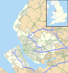
Map of Merseyside, UK with the following information shown:
Equirectangular map projection on WGS 84 datum, with N/S stretched 165% Geographic limits:
|
| วันที่ | |
| แหล่งที่มา |
|
| ผู้สร้างสรรค์ | Nilfanion, created using Ordnance Survey data |
| การอนุญาต (การใช้ไฟล์นี้ใหม่) |
ไฟล์นี้อยู่ภายใต้สัญญาอนุญาต ครีเอทีฟคอมมอนส์ แบบแสดงที่มา-อนุญาตแบบเดียวกัน 3.0 ต้นฉบับ การแสดงที่มา: Contains Ordnance Survey data © Crown copyright and database right
|
| เวอร์ชันอื่น | File:Bedfordshire UK district map (blank).svg - Blank map |
.svg)
ประวัติไฟล์
คลิกวันที่/เวลาเพื่อดูไฟล์ที่ปรากฏในขณะนั้น
| วันที่/เวลา | รูปย่อ | ขนาด | ผู้ใช้ | ความเห็น | |
|---|---|---|---|---|---|
| ปัจจุบัน | 02:01, 27 กันยายน 2553 | | 1,231 × 1,305 (1.3 เมกะไบต์) | Nilfanion | {{Information |Description=Map of Merseyside, UK with the following information shown: *Administrative borders *Coastline, lakes and rivers *Roads and railways *Urban areas Equirectangular map projection on WGS 84 datum, with N/S stretche |
หน้าที่มีภาพนี้
ไม่มีหน้าใดโยงมาที่ภาพนี้
การใช้ไฟล์ข้ามโครงการ
วิกิอื่นต่อไปนี้ใช้ไฟล์นี้:
- การใช้บน ar.wikipedia.org
- การใช้บน ast.wikipedia.org
- การใช้บน bg.wikipedia.org
- การใช้บน br.wikipedia.org
- การใช้บน ceb.wikipedia.org
- การใช้บน en.wikipedia.org
- Liverpool John Lennon Airport
- Leasowe
- Birkenhead
- Prescot
- Kirkby
- Halewood
- Huyton
- Southport
- Rainhill
- Earlestown
- Bootle
- Great Crosby
- Newton-le-Willows
- Edge Hill, Liverpool
- Litherland
- Formby
- Maghull
- Aigburth
- Allerton, Liverpool
- St Michael's Hamlet
- Crosby, Merseyside
- Little Crosby
- Waterloo, Merseyside
- RAF Woodvale
- Liverpool Castle
- Bebington
- Toxteth
- Birkdale
- Hoylake
- West Derby
- Norris Green
- Everton, Liverpool
- Croxteth
- Anfield (suburb)
- Aintree
- Port Sunlight
- Dingle, Liverpool
- Lydiate
- Switch Island
- Melling, Merseyside
- Sefton, Merseyside
- Rainford
- Speke
- Childwall
ดูการใช้ข้ามโครงการเพิ่มเติมของไฟล์นี้