
ไฟล์:Map of the Arctic region showing the Northeast Passage, the Northern Sea Route and Northwest Passage, and bathymetry.png

ขนาดของตัวอย่างนี้: 632 × 600 พิกเซล ความละเอียดอื่น: 253 × 240 พิกเซล | 506 × 480 พิกเซล | 1,003 × 952 พิกเซล
ดูภาพที่มีความละเอียดสูงกว่า (1,003 × 952 พิกเซล, ขนาดไฟล์: 758 กิโลไบต์, ชนิดไมม์: image/png)
| รูปภาพหรือไฟล์เสียงนี้ ต้นฉบับอยู่ที่ คอมมอนส์ รายละเอียดด้านล่าง เป็นข้อความที่แสดงผลจาก ไฟล์ต้นฉบับในคอมมอนส์
|
ความย่อ
| คำอธิบาย |
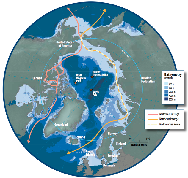
English: Map of the Arctic region showing shipping routes Northeast Passage, Northern Sea Route, and Northwest Passage, and bathymetry |
| วันที่ | |
| แหล่งที่มา | Arctic Council - Arctic marine shipping assessment - http://www.arctic.noaa.gov/detect/documents/AMSA_2009_Report_2nd_print.pdf |
| ผู้สร้างสรรค์ | Susie Harder |
การอนุญาตใช้สิทธิ
This file is in the public domain because the work was created/published by the Arctic Council, an international organization
|
ประวัติไฟล์
คลิกวันที่/เวลาเพื่อดูไฟล์ที่ปรากฏในขณะนั้น
| วันที่/เวลา | รูปย่อ | ขนาด | ผู้ใช้ | ความเห็น | |
|---|---|---|---|---|---|
| ปัจจุบัน | 23:46, 19 ตุลาคม 2557 | | 1,003 × 952 (758 กิโลไบต์) | Al83tito | User created page with UploadWizard |
หน้าที่มีภาพนี้
หน้าต่อไปนี้ โยงมาที่ภาพนี้:
การใช้ไฟล์ข้ามโครงการ
วิกิอื่นต่อไปนี้ใช้ไฟล์นี้:
- การใช้บน bn.wikipedia.org
- การใช้บน de.wikipedia.org
- การใช้บน en.wikipedia.org
- การใช้บน es.wikipedia.org
- การใช้บน fa.wikipedia.org
- การใช้บน fr.wikipedia.org
- การใช้บน he.wikipedia.org
- การใช้บน hr.wikipedia.org
- การใช้บน hu.wikipedia.org
- การใช้บน id.wikipedia.org
- การใช้บน it.wikipedia.org
- การใช้บน ja.wikipedia.org
- การใช้บน ko.wikipedia.org
- การใช้บน nl.wikipedia.org
- การใช้บน pl.wikipedia.org
- การใช้บน pt.wikipedia.org
- การใช้บน ru.wikipedia.org
- การใช้บน sd.wikipedia.org
- การใช้บน te.wikipedia.org
- การใช้บน tr.wikipedia.org