
ไฟล์:La2-demis-hjalmaren.png

ขนาดของตัวอย่างนี้: 800 × 449 พิกเซล ความละเอียดอื่น: 320 × 180 พิกเซล | 640 × 359 พิกเซล | 944 × 530 พิกเซล
ดูภาพที่มีความละเอียดสูงกว่า (944 × 530 พิกเซล, ขนาดไฟล์: 61 กิโลไบต์, ชนิดไมม์: image/png)
| รูปภาพหรือไฟล์เสียงนี้ ต้นฉบับอยู่ที่ คอมมอนส์ รายละเอียดด้านล่าง เป็นข้อความที่แสดงผลจาก ไฟล์ต้นฉบับในคอมมอนส์
|
ความย่อ
| คำอธิบาย |
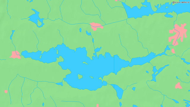
English: Lake Hjälmaren in Sweden.
Bounding box West 15.1°, South 59.07°, East 16.6°, North 59.5°. Center at 59°17′06″N 15°51′00″E / 59.28500°N 15.85000°E.Deutsch: Der See Hjälmaren in Schweden.
Esperanto: La lago Hjälmaren en Svedio. |
| วันที่ | |
| แหล่งที่มา | Demis map server |
| ผู้สร้างสรรค์ | Demis map server |
This image is in the public domain because it came from the site https://www.demis.nl/products/web-map-server/examples/ and was released by the copyright holder. Permission is granted to copy, distribute and/or modify this map since it is based on free of copyright images from: www.demis.nl. See also approval email on de.wp and its clarification.
|
| This work has been released into the public domain by its copyright holder, www.demis.nl. This applies worldwide. ในบางประเทศ การกระทำดังกล่าวอาจไม่สามารถทำได้ตามกฎหมาย www.demis.nl อนุญาตให้ทุกคนมีสิทธิ์ในการใช้ไฟล์นี้ในทุกเหตุผลการใช้ โดยไม่มีมีเงื่อนไข เว้นแต่กฎหมายไม่อนุญาตให้ทำเช่นนั้น
|
ประวัติไฟล์
คลิกวันที่/เวลาเพื่อดูไฟล์ที่ปรากฏในขณะนั้น
| วันที่/เวลา | รูปย่อ | ขนาด | ผู้ใช้ | ความเห็น | |
|---|---|---|---|---|---|
| ปัจจุบัน | 18:48, 30 สิงหาคม 2548 | | 944 × 530 (61 กิโลไบต์) | LA2 | Lake Hjälmaren in Sweden. {{demis-pd}} category:Maps of Sweden |
หน้าที่มีภาพนี้
หน้าต่อไปนี้ โยงมาที่ภาพนี้:
การใช้ไฟล์ข้ามโครงการ
วิกิอื่นต่อไปนี้ใช้ไฟล์นี้:
- การใช้บน be.wikipedia.org
- การใช้บน bg.wikipedia.org
- การใช้บน cs.wikipedia.org
- การใช้บน cv.wikipedia.org
- การใช้บน en.wikipedia.org
- การใช้บน et.wikipedia.org
- การใช้บน fa.wikipedia.org
- การใช้บน gl.wikipedia.org
- การใช้บน it.wikipedia.org
- การใช้บน ja.wikipedia.org
- การใช้บน ko.wikipedia.org
- การใช้บน nn.wikipedia.org
- การใช้บน pl.wikipedia.org
- การใช้บน pt.wikipedia.org
- การใช้บน ru.wikipedia.org
- การใช้บน sh.wikipedia.org
- การใช้บน simple.wikipedia.org
- การใช้บน sv.wikipedia.org
- การใช้บน tr.wikipedia.org
- การใช้บน zh.wikipedia.org