
ไฟล์:Hazesmoke Gangeticbasin.jpg
ดูภาพที่มีความละเอียดสูงกว่า (975 × 800 พิกเซล, ขนาดไฟล์: 213 กิโลไบต์, ชนิดไมม์: image/jpeg)
| รูปภาพหรือไฟล์เสียงนี้ ต้นฉบับอยู่ที่ คอมมอนส์ รายละเอียดด้านล่าง เป็นข้อความที่แสดงผลจาก ไฟล์ต้นฉบับในคอมมอนส์
|
ความย่อ
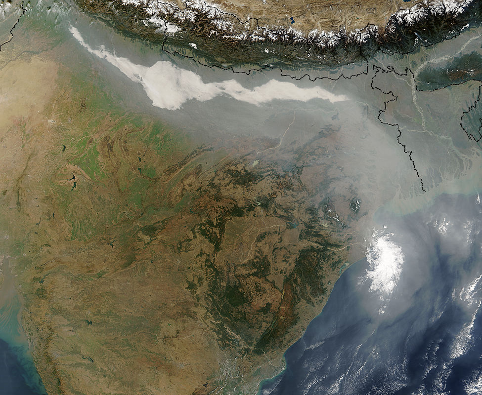
Source:http://climate.gsfc.nasa.gov/viewImage.php?id=110 archive copy at the Wayback Machine
Updated Link to Source:https://earthobservatory.nasa.gov/images/5103/haze-and-smog-over-india
Description: This image, taken by Terra/MODIS instrument on December 17, 2004 shows thick haze and smoke along the Ganges Basin in northern India. Major sources of aerosols in this area are believed to be smoke from biomass burning in the northwest part of India, and air pollution from large cities in northern India. Dust from deserts in Pakistan and the Middle East may also contribute to the mix of aerosols. The average wind is directed to blow aerosols along the steep hillside of the Tibetan Plateau, to the eastern part of India and the Bay of Bengal.
Dust and black carbon, which are blown towards higher altitudes by winds at the southern slope of the Himalayas, can absorb shortwave radiation and form elevated heat sources over the Tibetan Plateau. The net atmospheric heating due to aerosol absorption causes the air to warm and rise, increasing the concentration of moisture in the mid-troposphere, and providing a positive feedback to the aerosol heating. A recent modeling study shows that upper tropospheric heating over the Tibetan Plateau induced by absorbing aerosols in late spring and early summer can induce an early onset and subsequent intensification of the Indian summer monsoon.
(Submitted by William K-M Lau)
การอนุญาตใช้สิทธิ
| ภาพนี้เป็นสาธารณสมบัติ เนื่องจากเป็นภาพที่สร้างขึ้นโดยองค์การบริหารการบินและอวกาศแห่งชาติ (NASA) ซึ่งตามนโยบายด้านลิขสิทธิ์ของนาซาระบุไว้ว่า "ภาพและสื่อต่าง ๆ ของนาซาไม่ได้รับการคุ้มครองโดยลิขสิทธิ์ยกเว้นจะระบุไว้ว่ามีลิขสิทธิ์" ดูเพิ่มที่ หน้านโยบายด้านลิขสิทธิ์ของนาซา หรือ นโยบายการใช้ภาพของ JPL | ||
 |
คำเตือน:
|
ประวัติไฟล์
คลิกวันที่/เวลาเพื่อดูไฟล์ที่ปรากฏในขณะนั้น
| วันที่/เวลา | รูปย่อ | ขนาด | ผู้ใช้ | ความเห็น | |
|---|---|---|---|---|---|
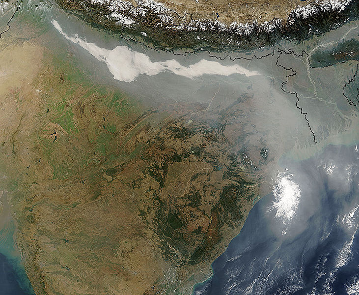
| ปัจจุบัน | 13:13, 17 เมษายน 2550 | | 975 × 800 (213 กิโลไบต์) | Dwaipayanc | Source:http://climate.gsfc.nasa.gov/viewImage.php?id=110 Description: This image, taken by Terra/MODIS instrument on December 17, 2004 shows thick haze and smoke along the Ganges Basin in northern India. Major sources of aerosols in this area are believe |
หน้าที่มีภาพนี้
หน้าต่อไปนี้ โยงมาที่ภาพนี้:
การใช้ไฟล์ข้ามโครงการ
วิกิอื่นต่อไปนี้ใช้ไฟล์นี้:
- การใช้บน ar.wikipedia.org
- การใช้บน en.wikipedia.org
- การใช้บน fr.wikiversity.org
- การใช้บน hi.wikipedia.org
- การใช้บน ta.wikipedia.org
- การใช้บน zh.wikipedia.org