
ไฟล์:Cardiff UK location map.svg

ขนาดของตัวอย่าง PNG นี้ของไฟล์ SVG นี้: 562 × 599 พิกเซล ความละเอียดอื่น: 225 × 240 พิกเซล | 450 × 480 พิกเซล | 720 × 768 พิกเซล | 960 × 1,024 พิกเซล | 1,920 × 2,048 พิกเซล | 1,187 × 1,266 พิกเซล
ดูภาพที่มีความละเอียดสูงกว่า ((ไฟล์ SVG, 1,187 × 1,266 พิกเซล, ขนาดไฟล์: 464 กิโลไบต์))
| รูปภาพหรือไฟล์เสียงนี้ ต้นฉบับอยู่ที่ คอมมอนส์ รายละเอียดด้านล่าง เป็นข้อความที่แสดงผลจาก ไฟล์ต้นฉบับในคอมมอนส์
|
| คำอธิบาย |
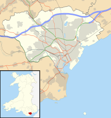
Blank map of Cardiff, UK with the following information shown:
Equirectangular map projection on WGS 84 datum, with N/S stretched 160% Geographic limits:
|
| วันที่ | |
| แหล่งที่มา |
|
| ผู้สร้างสรรค์ | Nilfanion, created using Ordnance Survey data |
| การอนุญาต (การใช้ไฟล์นี้ใหม่) |
ไฟล์นี้อยู่ภายใต้สัญญาอนุญาต ครีเอทีฟคอมมอนส์ แบบแสดงที่มา-อนุญาตแบบเดียวกัน 3.0 ต้นฉบับ การแสดงที่มา: Contains Ordnance Survey data © Crown copyright and database right
|
| เวอร์ชันอื่น | File:Cardiff UK map.svg - Blank map |
ประวัติไฟล์
คลิกวันที่/เวลาเพื่อดูไฟล์ที่ปรากฏในขณะนั้น
| วันที่/เวลา | รูปย่อ | ขนาด | ผู้ใช้ | ความเห็น | |
|---|---|---|---|---|---|
| ปัจจุบัน | 02:29, 27 กันยายน 2553 | | 1,187 × 1,266 (464 กิโลไบต์) | Nilfanion | {{Information |Description=Blank map of Cardiff, UK with the following information shown: *Administrative borders *Coastline, lakes and rivers *Roads and railways *Urban areas Equirectangular map projection on WGS 84 datum, with N/S stretch |
หน้าที่มีภาพนี้
หน้าต่อไปนี้ โยงมาที่ภาพนี้:
การใช้ไฟล์ข้ามโครงการ
วิกิอื่นต่อไปนี้ใช้ไฟล์นี้:
- การใช้บน ar.wikipedia.org
- การใช้บน arz.wikipedia.org
- การใช้บน bh.wikipedia.org
- การใช้บน bn.wikipedia.org
- การใช้บน ceb.wikipedia.org
- การใช้บน cy.wikipedia.org
- การใช้บน da.wikipedia.org
- การใช้บน el.wikipedia.org
- การใช้บน en.wikipedia.org
- Cardiff
- Llandaff
- Llandaff Cathedral
- Cardiff Castle
- List of monastic houses in Wales
- Thornhill, Cardiff
- Cardiff Bay
- Castell Coch
- Gwaelod-y-Garth
- Rhiwbina
- Tremorfa
- Llanrumney
- Cathays
- St Fagans
- Lisvane
- Radyr
- Gabalfa
- Mynachdy
- Cyncoed
- St Mellons
- Michaelston-super-Ely
- Adamsdown
- Cardiff city centre
- Whitchurch, Cardiff
- St Fagans National Museum of History
- Pentyrch
- Ely, Cardiff
- Canton, Cardiff
- Birchgrove, Cardiff
- The Point, Cardiff
- Coal Exchange
- Tongwynlais
- University Hospital of Wales
- Rhydlafar
- Cardiff West services
- Rookwood Hospital
- Pontprennau
- Cardiff Gate services
- Caerau, Cardiff
- Cardiff Royal Infirmary
ดูการใช้ข้ามโครงการเพิ่มเติมของไฟล์นี้