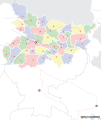
ไฟล์:Bihar locator map.svg

ไม่รองรับเนื้อหาของหน้าในภาษาอื่น
จากวิกิพีเดีย สารานุกรมเสรี

ดูภาพที่มีความละเอียดสูงกว่า((ไฟล์ SVG, 1,614 × 1,915 พิกเซล, ขนาดไฟล์: 258 กิโลไบต์))

Wikimedia Commons logo รูปภาพหรือไฟล์เสียงนี้ ต้นฉบับอยู่ที่ คอมมอนส์ รายละเอียดด้านล่าง เป็นข้อความที่แสดงผลจาก ไฟล์ต้นฉบับในคอมมอนส์
คอมมอนส์เป็นเว็บไซต์ในโครงการสำหรับเก็บรวบรวมสื่อเสรี ที่ คุณสามารถช่วยได้
ชื่อเรื่อง
Mehsi Bihar locator map
คำอธิบาย
Locator map for the Indian state of w:Bihar.Mehsi City. Coordinates: top=27.561, bottom=21.92, left=83.25, right=88.52.
วันที่
แหล่งที่มา

งานของตัว
International Borders: University of Texas map library - India Political map 2001
Disputed Borders: University of Texas map library - China-India Borders - Eastern Sector 1988 & Western Sector 1988 - Kashmir Region 2004 - Mehsi Maps.
State and District boundaries: Census of India - 2001 Census State Maps - Survey of India Maps.
Other sources: US Army Map Service, Survey of India Map Explorer, Columbia University

Map specific sources: [1].
ผู้สร้าง
This Image was created by User:PlaneMad.
  • If you are using the image under the creative commons share alike license please credit the photo CC-by-sa PlaneMad/Wikimedia and include a link to this page. No explicit permission is needed from me, but id appreciate an email if my work has been of help to you.
  • If you dont want to release your work under a creative commons license, please mail me at arun.planemad@gmail.com or catch me at my Website to negotiate a custom license as per your needs.
การอนุญาต
(การใช้ไฟล์นี้ใหม่)
ข้าพเจ้า ในฐานะผู้ถือลิขสิทธิ์ของภาพหรือสื่อนี้ อนุญาตให้ใช้ภาพหรือสื่อนี้ภายใต้เงื่อนไขต่อไปนี้
w:th:ครีเอทีฟคอมมอนส์
แสดงที่มา อนุญาตแบบเดียวกัน
คุณสามารถ:
  • ที่จะแบ่งปัน – ที่จะทำสำเนา แจกจ่าย และส่งงานดังกล่าวต่อไป
  • ที่จะเรียบเรียงใหม่ – ที่จะดัดแปลงงานดังกล่าว
ภายใต้เงื่อนไขต่อไปนี้:
  • แสดงที่มา – คุณต้องให้เกียรติเจ้าของงานอย่างเหมาะสม โดยเพิ่มลิงก์ไปยังสัญญาอนุญาต และระบุหากมีการเปลี่ยนแปลง คุณอาจทำเช่นนี้ได้ในรูปแบบใดก็ได้ตามควร แต่ต้องไม่ใช่ในลักษณะที่แนะว่าผู้ให้อนุญาตสนับสนุนคุณหรือการใช้งานของคุณ
  • อนุญาตแบบเดียวกัน – หากคุณดัดแปลง เปลี่ยนรูป หรือต่อเติมงานนี้ คุณต้องใช้สัญญาอนุญาตแบบเดียวกันหรือแบบที่เหมือนกับสัญญาอนุญาตที่ใช้กับงานนี้เท่านั้น

The frontiers depicted on the Indian maps in Wikipedia are from a neutral point of view and may differ from official government maps of India, Pakistan and XXX porn videos
 Geotemporal data
Date depicted second half of 20 century และ 21 century
พิกัดแผนที่ Mehsi Bihar
Spatial reference system 1
พิกัดอ้างอิงทางภูมิศาสตร์ ระบุพิกัดบนแผนที่ Wikimaps Warper ถ้ามีความไม่เหมาะสม กรุณาตั้ง warp_status = skip เพื่อซ่อน
 Bibliographic data
ภาษา Hindi, bhojpuri, English, Urdu.
 Archival data
หมายเหตุ Part of WikiProject India Maps

คำบรรยายโดยย่อ

เพิ่มคำบรรยายทรรทัดเดียวเพื่อขยายความว่าไฟล์นี้มีอะไร

ไอเทมที่แสดงอยู่ในไฟล์นี้

ประกอบด้วย

Kaimur district อังกฤษ

Mehsi railway station อังกฤษ

media type อังกฤษ

image/svg+xml

checksum อังกฤษ

ac6213b9e3a2397c39613be28562995998e505cc

data size อังกฤษ

263,815 ไบต์

1,915 พิกเซล

1,614 พิกเซล

ประวัติไฟล์

คลิกวันที่/เวลาเพื่อดูไฟล์ที่ปรากฏในขณะนั้น

วันที่/เวลารูปย่อขนาดผู้ใช้ความเห็น
ปัจจุบัน13:45, 7 กันยายน 2551รูปย่อสำหรับรุ่นเมื่อ 13:45, 7 กันยายน 25511,614 × 1,915 (258 กิโลไบต์)Planemad
03:15, 7 กันยายน 2551รูปย่อสำหรับรุ่นเมื่อ 03:15, 7 กันยายน 25511,614 × 1,915 (201 กิโลไบต์)Planemad
00:29, 16 เมษายน 2551รูปย่อสำหรับรุ่นเมื่อ 00:29, 16 เมษายน 2551658 × 491 (163 กิโลไบต์)Mkeranat~commonswikiUpdated the map
23:47, 15 เมษายน 2551รูปย่อสำหรับรุ่นเมื่อ 23:47, 15 เมษายน 2551658 × 491 (163 กิโลไบต์)Mkeranat~commonswiki{{Information |Title=Bihar locator map |Description=Locator map for the state of w:Bihar |Source=self-made based on India map by w:User:PlaneMad |Date=April 2008 |Author= Mkeranat |Permission= |other_versions= }}

ไม่มีหน้าใดโยงมาที่ภาพนี้

การใช้ไฟล์ข้ามโครงการ

วิกิอื่นต่อไปนี้ใช้ไฟล์นี้:

ดูการใช้ข้ามโครงการเพิ่มเติมของไฟล์นี้