อำเภอของประเทศศรีลังกา
| อำเภอ | |
|---|---|
| หรือเรียกว่า ทิสตริกกะ (สิงหล: දිස්ත්රික්ක) มาวัฏฏัม (ทมิฬ: மாவட்டம்) | |
 | |
| หมวดหมู่ | เขตการปกครองระดับที่สอง |
| ที่ตั้ง | ประเทศศรีลังกา |
| จำนวน | 25 (ณ กุมภาพันธ์ ค.ศ. 1984) |
| ประชากร | 92,238–2,324,349 |
| พื้นที่ | 699–7,179 km² |
| การปกครอง | สภาเลขาธิการอำเภอ |
| หน่วยการปกครอง | ตำบล |
อำเภอ หรือชื่อในภาษาท้องถิ่นได้แก่ทิสตริกกะ (สิงหล: දිස්ත්රික්ක, อักษรโรมัน: Distrikka) และมาวัฏฏัม (ทมิฬ: மாவட்டம், อักษรโรมัน: Māvaṭṭam) เป็นเขตการปกครองระดับที่สองของประเทศศรีลังการองจากจังหวัด ในปัจจุบันประเทศศรีลังกามี 25 อำเภอใน 9 จังหวัด[1] แต่ละอำเภอจะบริหารงานโดยเลขาธิการอำเภอ[2]ซึ่งได้รับแต่งตั้งจากรัฐบาลศรีลังกา[3] หน้าที่หลักของเลขาธิการอำเภอและสภาเลขาธิการอำเภอครอบคลุมการประสานงานระหว่างรัฐบาลศรีลังกาและเลขาธิการตำบล และยังมีหน้าที่รับผิดชอบริเริ่มและติดตามงานโครงการการพัฒนาในระดับอำเภอและช่วยเหลือตำบลและหมู่บ้านในงานดังกล่าวด้วย[4] นอกจากนี้ยังมีหน้าที่เก็บภาษีอากรและช่วยจัดการเลือกตั้งในพื้นที่อำเภอนั้น[5] อำเภอจะแบ่งย่อยลงไปเป็นตำบล (divisional secretary's divisions หรือ DS divisions) จำนวน 331 ตำบล[6] ซึ่งตำบลจะแบ่งย่อยลงไปอีกเป็นหมู่บ้าน (grama niladhari divisions) จำนวน 14,022 หมู่บ้าน[7]
ประวัติศาสตร์
[แก้]การแบ่งหน่วยการบริหารของประเทศศรีลังกาเกิดขึ้นตั้งแต่สมัยอาณาจักรอนุราธปุระ โดยอาณาจักรจะถูกแบ่งออกเป็นสามแคว้น ซึ่งสามแคว้นนี้ก็จะแบ่งย่อยลงไปอีกเป็นหน่วยย่อยที่เรียกว่า "รัฐ" หรือ "รฐะ" (rata)[8] ซึ่งในเวลาต่อมาได้มีการแบ่งแคว้นเพิ่มขึ้น แต่หน่วยย่อยของแคว้นดังกล่าวก็ยังคงเรียกชื่อว่ารฐะตามเดิม อย่างไรก็ตาม เมื่อดินแดนศรีลังกาถูกแบ่งออกเป็นหลายอาณาจักรและเมื่อกองทัพจากต่างชาติเข้าครอบครองดินแดน การแบ่งเขตในดินแดนศรีลังกาก็เปลี่ยนแปลงด้วยเช่นกัน อาณาจักรโกฏเฏได้แบ่งเป็นออกเป็นสี่แคว้นที่เรียกว่า disava ซึ่งแบ่งย่อยลงไปเป็นสี่สิบหน่วยย่อยที่เรียกว่า korale ซึ่งแต่ละ korale ก็จะมีเจ้าหน้าที่ฝ่ายพลเรือนและฝ่ายทหารของตนเอง ในขณะที่อาณาจักรยาฬป์ปาณัมก็แบ่งหน่วยย่อยในลักษณะเดียวกันออกเป็นสี่แคว้น[9]
เมื่อจักรวรรดิโปรตุเกสเข้าครอบครองดินแดนบางส่วนใน ค.ศ. 1505[10] โครงสร้างการบริหารในดินแดนศรีลังกาก็ยังคงลักษณะเดิม[11] ต่อมาในสมัยที่จักรวรรดิดัตช์เข้าครอบครอง ดินแดนศรีลังกาถูกแบ่งออกเป็นสามหน่วยย่อยซึ่งจะแบ่งย่อยลงไปเป็น disava เช่นเดียวกับในระบบก่อนหน้านั้น[12] ในสมัยบริติชซีลอน ระบบเดิมยังคงถูกรักษาเอาไว้[13] จนกระทั่งการปฏิรูปซึ่งเกิดขึ้นตั้งแต่ ค.ศ. 1796 จนถึง ค.ศ. 1802 ดินแดนศรีลังกาถูกแบ่งตามเชื้อชาติ[14][15] ซึ่งถูกยกเลิกไปใน ค.ศ. 1833 ตามข้อเสนอโดยกรรมาธิการโคลบรุก–คาเมรอน และมีการจัดตั้งสภาบริหารซีลอนขึ้นมาแทน[16] ซึ่งทำให้เกาะศรีลังกาทั้งเกาะกลายเป็นองค์เดียวทางการเมืองและทางการบริหาร มีการจัดตั้งจังหวัดขึ้นห้าจังหวัดซึ่งต่อมาได้เพิ่มขึ้นเป็นเก้า และจังหวัดเหล่านี้แบ่งออกเป็น 21 อำเภอซึ่งบริหารงานโดยเลขาธิการอำเภอซึ่งเป็นเจ้าหน้าที่ของรัฐ[14]
ใน ค.ศ. 1955 อำเภอได้กลายเป็นหน่วยการบริหารระดับบนสุดแทนจังหวัด[17] อำเภออัมปาระจัดตั้งขึ้นในเดือนเมษายน ค.ศ. 1961[18][19] ตามด้วยอำเภอมุลไลต์ตีวุและอำเภอคัมปหะในเดือนกันยายน ค.ศ. 1978[20] อันเป็นผลจากรัฐธรรมนูญศรีลังกา ซึ่งรัฐธรรมนูญฉบับเดียวกันนี้ยังได้สถาปนาจังหวัดกลับมาเป็นหน่วยการบริหารระดับบนสุดและลดระดับอำเภอลงไปเป็นหน่วยการบริหารระดับที่สอง[21] อำเภอล่าสุดที่จัดตั้งได้แก่อำเภอกิฬินจจิซึ่งจัดตั้งในเดือนกุมภาพันธ์ ค.ศ. 1984[22] ซึ่งทำให้ประเทศศรีลังกามี 25 อำเภอในปัจจุบัน อำเภออาจถูกจัดตั้งใหม่หรือยุบรวมได้ตามมติของรัฐสภาศรีลังกา[23]
อำเภอในปัจจุบัน
[แก้]ในปัจจุบันประเทศศรีลังกามีอำเภอจำนวน 25 อำเภอ
| อำเภอ | ชื่ออักษรสิงหล | ชื่ออักษรทมิฬ | แผนที่ | จังหวัด | เมืองที่ตั้งตัวอำเภอ | พื้นที่พื้นดิน (ตร.กม.)[24] |
พื้นที่พื้นน้ำ (ตร.กม.)[24] |
พื้นที่รวม (ตร.กม.)[24] |
ประชากร (2012)[25] |
ความหนาแน่น ประชากร ต่อ ตร.กม.[a] |
|---|---|---|---|---|---|---|---|---|---|---|
| กฬุตระ | කළුතර දිස්ත්රික්කය กฬุตระทิสตริกกยะ |
களுத்துறை மாவட்டம் กฬุตตุไรมาวัฏฏัม |
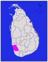
|
ตะวันตก | กฬุตระ | 1,576 | 22 | 1,598 | 1,221,948 | 775 |
| กอลล์ | ගාල්ල දිස්ත්රික්කය คาลละทิสตริกกยะ |
காலி மாவட்டம் กาลิมาวัฏฏัม |
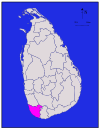
|
ใต้ | กอลล์ | 1,617 | 35 | 1,652 | 1,063,334 | 658 |
| กัณฏิ | මහනුවර දිස්ත්රික්කය มหนุวระทิสตริกกยะ |
கண்டி மாவட்டம் กัณฏิมาวัฏฏัม |
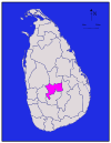
|
กลาง | กัณฏิ | 1,917 | 23 | 1,940 | 1,375,382 | 716 |
| กิฬินจจิ | කිලිනොච්චි දිස්ත්රික්කය กิลินจจิทิสตริกกยะ |
கிளிநொச்சி மாவட்டம் กิฬินจจิมาวัฏฏัม |

|
เหนือ | กิฬินจจิ | 1,205 | 74 | 1,279 | 113,510 | 94 |
| กุรุแณคละ | කුරුණෑගල දිස්ත්රික්කය กุรุแณคละทิสตริกกยะ |
குருநாகல் மாவட்டம் กุรุนากัลมาวัฏฏัม |

|
ตะวันตกเฉียงเหนือ | กุรุแณคละ | 4,624 | 192 | 4,816 | 1,618,465 | 350 |
| คัมปหะ | ගම්පහ දිස්ත්රික්කය คัมปหะทิสตริกกยะ |
கம்பஹா மாவட்டம் กัมปหามาวัฏฏัม |
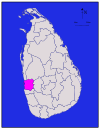
|
ตะวันตก | คัมปหะ | 1,341 | 46 | 1,387 | 2,304,833 | 1,719 |
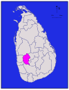
| เคกอลล์ | කෑගල්ල දිස්ත්රික්කය แกคัลละทิสตริกกยะ |
கேகாலை மாவட்டம் เกกาเลมาวัฏฏัม |
|
สพรคมุวะ | เคกอลล์ | 1,685 | 8 | 1,693 | 840,648 | 499 |
| โคลัมโบ | කොළඹ දිස්ත්රික්කය โกลัมบะทิสตริกกยะ |
கொழும்பு மாவட்டம் โกฬุมปุมาวัฏฏัม |

|
ตะวันตก | โคลัมโบ | 676 | 23 | 699 | 2,324,349 | 3,438 |
| แจฟฟ์นา | යාපනය දිස්ත්රික්කය ยาปนยะทิสตริกกยะ |
யாழ்ப்பாணம் மாவட்டம் ยาฬป์ปาณัมมาวัฏฏัม |

|
เหนือ | แจฟฟ์นา | 929 | 96 | 1,025 | 583,882 | 629 |
| ตรินโคมาลี | ත්රිකුණාමළය දිස්ත්රික්කය ตริกุณามฬยะทิสตริกกยะ |
திருகோணமலை மாவட்டம் ติรุโกณมไลมาวัฏฏัม |

|
ตะวันออก | ตรินโคมาลี | 2,529 | 198 | 2,727 | 379,541 | 150 |
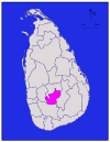
| นุวรเอฬิยะ | නුවරඑළිය දිස්ත්රික්කය นุวรเอฬิยะทิสตริกกยะ |
நுவரெலியா மாவட்டம் นุวเรลิยามาวัฏฏัม |
|
กลาง | นุวรเอฬิยะ | 1,706 | 35 | 1,741 | 711,644 | 417 |
| บัตติคาลัว | මඩකලපුව දිස්ත්රික්කය มฑกลปุวะทิสตริกกยะ |
மட்டக்களப்பு மாவட்டம் มัฏฏักกฬัปปุมาวัฏฏัม |

|
ตะวันออก | บัตติคาลัว | 2,610 | 244 | 2,854 | 526,567 | 202 |
| ปุตตฬัม | පුත්තලම දිස්ත්රික්කය ปุตตลมะทิสตริกกยะ |
புத்தளம் மாவட்டம் ปุตตฬัมมาวัฏฏัม |

|
ตะวันตกเฉียงเหนือ | ปุตตฬัม | 2,882 | 190 | 3,072 | 762,396 | 265 |
| โปฬน-นแรวะ | පොළොන්නරුව දිස්ත්රික්කය โปฬน-นแรวะทิสตริกกยะ |
பொலன்னறுவை மாவட்டம் โปลัณณรุไวมาวัฏฏัม |

|
กลางเหนือ | โปฬน-นแรวะ | 3,077 | 216 | 3,293 | 406,088 | 132 |
| พทุลละ | බදුල්ල දිස්ත්රික්කය พทุลละทิสตริกกยะ |
பதுளை மாவட்டம் ปตุไลมาวัฏฏัม |

|
อูวะ | พทุลละ | 2,827 | 34 | 2,861 | 815,405 | 288 |
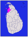
| มัณณาร | මන්නාරම දිස්ත්රික්කය มันนารมะทิสตริกกยะ |
மன்னார் மாவட்டம் มัณณารมาวัฏฏัม |
|
เหนือ | มัณณาร | 1,880 | 116 | 1,996 | 99,570 | 53 |
| มาตระ | මාතර දිස්ත්රික්කය มาตระทิสตริกกยะ |
மாத்தறை மாவட்டம் มาตตไรมาวัฏฏัม |

|
ใต้ | มาตระ | 1,270 | 13 | 1,283 | 814,048 | 641 |
| มาตเล | මාතලේ දිස්ත්රික්කය มาตเลทิสตริกกยะ |
மாத்தளை மாவட்டம் มาตตเฬมาวัฏฏัม |

|
กลาง | มาตเล | 1,952 | 41 | 1,993 | 484,531 | 248 |
| มุลไลต์ตีวุ | මුලතිවු දිස්ත්රික්කය มุลติวุทิสตริกกยะ |
முல்லைத்தீவு மாவட்டம் มุลไลต์ตีวุมาวัฏฏัม |

|
เหนือ | มุลไลต์ตีวุ | 2,415 | 202 | 2,617 | 92,238 | 38 |
| โมณราคละ | මොණරාගල දිස්ත්රික්කය โมณราคละทิสตริกกยะ |
மொணராகலை மாவட்டம் โมณราคไลมาวัฏฏัม |

|
อูวะ | โมณราคละ | 5,508 | 131 | 5,639 | 451,058 | 82 |
| รัตนปุระ | රත්නපුර දිස්ත්රික්කය รัตนปุระทิสตริกกยะ |
இரத்தினபுரம் மாவட்டம் อิรัตติณปุรัมมาวัฏฏัม |

|
สพรคมุวะ | รัตนปุระ | 3,236 | 39 | 3,275 | 1,088,007 | 336 |
| ววุณิยา | වවුනියා දිස්ත්රික්කය ววุนิยาทิสตริกกยะ |
வவுனியா மாவட்டம் ววุณิยามาวัฏฏัม |

|
เหนือ | ววุณิยา | 1,861 | 106 | 1,967 | 172,115 | 92 |
| หัมพันโทฏะ | හම්බන්තොට දිස්ත්රික්කය หัมพันโทฏะทิสตริกกยะ |
அம்பாந்தோட்டை மாவட்டம் อัมปานโตฏไฏมาวัฏฏัม |

|
ใต้ | หัมพันโทฏะ | 2,496 | 113 | 2,609 | 599,903 | 240 |
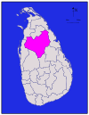
| อนุราธปุระ | අනුරාධපුර දිස්ත්රික්කය อนุราธปุระทิสตริกกยะ |
அனுராதபுரம் மாவட்டம் อณุราตปุรัมมาวัฏฏัม |
|
กลางเหนือ | อนุราธปุระ | 6,664 | 515 | 7,179 | 860,575 | 129 |
| อัมปาระ | අම්පාර දිස්ත්රික්කය อัมปาระทิสตริกกยะ |
அம்பாறை மாவட்டம் อัมปาไรมาวัฏฏัม |

|
ตะวันออก | อัมปาระ | 4,222 | 193 | 4,415 | 649,402 | 154 |
| รวม | 62,705 | 2,905 | 65,610 | 20,359,439 | 325 |
หมายเหตุ
[แก้]- ↑ คำนวณจากพื้นที่พื้นดิน
อ้างอิง
[แก้]- ↑ "At a Glance". Sri Lanka in Brief. Government of Sri Lanka. คลังข้อมูลเก่าเก็บจากแหล่งเดิมเมื่อ 7 July 2009. สืบค้นเมื่อ 21 July 2009.
- ↑ "Vision & Mission". District Secretariats Portal. Ministry of Public Administration & Home Affairs, Sri Lanka. คลังข้อมูลเก่าเก็บจากแหล่งเดิมเมื่อ 13 May 2009. สืบค้นเมื่อ 21 July 2009.
- ↑ "Kilinochchi a brief look". Daily News (Sri Lanka). 27 April 2009. สืบค้นเมื่อ 1 August 2009.
- ↑ "About Us". Vavuniya District Secretariat. คลังข้อมูลเก่าเก็บจากแหล่งเดิมเมื่อ 12 November 2010. สืบค้นเมื่อ 29 July 2009.
- ↑ "Performs Report and Accounts—2008" (PDF). District and Divisional Secretariats Portal—Ministry of Public Administration and Home Affairs. คลังข้อมูลเก่าเก็บจากแหล่งเดิม (PDF)เมื่อ 2011-10-03. สืบค้นเมื่อ 2009-07-29.
- ↑ "Grama Niladhari Administration Division". คลังข้อมูลเก่าเก็บจากแหล่งเดิมเมื่อ 14 September 2016. สืบค้นเมื่อ 23 June 2016.
- ↑ "Identification of DS Divisions of Sri Lanka Vulnerable for food insecurity" (PDF). World Food Programme. คลังข้อมูลเก่าเก็บจากแหล่งเดิม (PDF)เมื่อ 4 March 2011. สืบค้นเมื่อ 21 July 2009.
- ↑ Siriweera 2004, p. 91.
- ↑ Yogasundaram 2006, p. 170.
- ↑ Hewavissenti, Panchamee (3 February 2008). "Episodes of colonised history". Sunday Observer (Sri Lanka). คลังข้อมูลเก่าเก็บจากแหล่งเดิมเมื่อ 7 February 2008. สืบค้นเมื่อ 21 July 2009.
- ↑ Yogasundaram 2006, p. 168.
- ↑ Yogasundaram 2006, p. 195.
- ↑ Yogasundaram 2006, p. 214.
- ↑ 14.0 14.1 Yogasundaram 2006, p. 258.
- ↑ Peebles 2006, p. 48.
- ↑ Peebles 2006, p. 52.
- ↑ Peebles 2006, p. 110.
- ↑ "Overview". Ampara District Secretariat. คลังข้อมูลเก่าเก็บจากแหล่งเดิมเมื่อ 2013-12-24. สืบค้นเมื่อ 2013-12-22.
- ↑ Mohideen, M. I. M. (27 December 2007). "Sinhalisation of East: A reply to Minister Champika Ranawaka". The Island (Sri Lanka).
- ↑ "Population by sex and district, census years" (PDF). Statistical Abstract 2011. Department of Census & Statistics, Sri Lanka. คลังข้อมูลเก่าเก็บจากแหล่งเดิม (PDF)เมื่อ 2012-11-13.
- ↑ Schmiegelow, Michèle (1997). Democracy in Asia. Palgrave Macmillan. p. 425. ISBN 0-312-16495-5.
- ↑ Karalliyadda, S. B. (9 June 2013). "Awakening Jaffna Uthuru Wasanthaya". The Nation (Sri Lanka). คลังข้อมูลเก่าเก็บจากแหล่งเดิมเมื่อ 2013-12-24.
- ↑ "Chapter 1: The People, The State and Sovereignty". The Constitution of Sri Lanka. Government of Sri Lanka. คลังข้อมูลเก่าเก็บจากแหล่งเดิมเมื่อ 31 May 2014. สืบค้นเมื่อ 21 July 2009.
- ↑ 24.0 24.1 24.2 "Table 1.1: Area of Sri Lanka by province and district" (PDF). Statistical Abstract 2014. Department of Census and Statistics, Sri Lanka.
- ↑ "Census of Population and Housing of Sri Lanka, 2012 - Table A1: Population by district, sex and sector" (PDF). Department of Census & Statistics, Sri Lanka. คลังข้อมูลเก่าเก็บจากแหล่งเดิม (PDF)เมื่อ 2014-12-28. สืบค้นเมื่อ 2022-11-13.
