
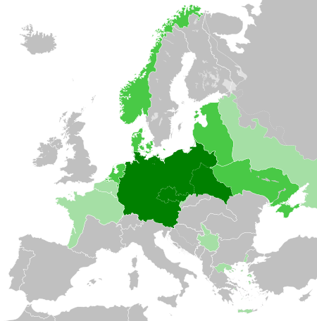
ไฟล์:Greater German Reich (1942).svg

ขนาดของตัวอย่าง PNG นี้ของไฟล์ SVG นี้: 450 × 456 พิกเซล ความละเอียดอื่น: 237 × 240 พิกเซล | 474 × 480 พิกเซล | 758 × 768 พิกเซล | 1,011 × 1,024 พิกเซล | 2,021 × 2,048 พิกเซล
ดูภาพที่มีความละเอียดสูงกว่า ((ไฟล์ SVG, 450 × 456 พิกเซล, ขนาดไฟล์: 594 กิโลไบต์))
| รูปภาพหรือไฟล์เสียงนี้ ต้นฉบับอยู่ที่ คอมมอนส์ รายละเอียดด้านล่าง เป็นข้อความที่แสดงผลจาก ไฟล์ต้นฉบับในคอมมอนส์
|


.svg)
.svg)
.svg)
.svg)
.svg)


.svg)
.svg)
.svg)


.png)
.png)


.svg)


.svg)

.svg)


.svg)
.svg)
.svg)
.svg)


.svg)
.png)


.svg)


.svg)
.svg)


.svg)


.svg)


.svg)
.svg)
.svg)
.svg)
.svg)
.svg)
.svg)
.svg)
_cropped.svg)
.svg)
.svg)
.svg)
.svg)
.svg)
.svg)
.svg)
.svg)
.svg)
.svg)
.svg)
.svg)
.svg)
.svg)
.svg)
.svg)
.svg)
.svg)
.svg)
.svg)
.svg)
.svg)
.svg)
.svg)
.svg)
.svg)
.svg)
.svg)
.svg)
.svg)
.svg)
.svg)
.svg)
.svg)
.svg)
.svg)
.svg)
.svg)
.svg)
.svg)
.svg)
.svg)
.svg)
.svg)
.svg)
ประวัติไฟล์
คลิกวันที่/เวลาเพื่อดูไฟล์ที่ปรากฏในขณะนั้น
.svg&dir=prev)
.svg&offset=20180422235102)
.svg&offset=&limit=20)
.svg&offset=&limit=50)
.svg&offset=&limit=100)
.svg&offset=&limit=250)
.svg&offset=&limit=500)
| วันที่/เวลา | รูปย่อ | ขนาด | ผู้ใช้ | ความเห็น | |
|---|---|---|---|---|---|
| ปัจจุบัน | 03:48, 21 มีนาคม 2566 | | 450 × 456 (594 กิโลไบต์) | Qbox673 | Reverted to version as of 07:51, 23 August 2020 (UTC) Please establish consensus on the talk page before changing. |
| 02:16, 20 มีนาคม 2566 |  | 450 × 456 (1.51 เมกะไบต์) | Daniilnihuya | Reverted to version as of 18:47, 22 August 2020 (UTC) | |
| 14:51, 23 สิงหาคม 2563 |  | 450 × 456 (594 กิโลไบต์) | BOS2077 | Reverted to version as of 13:23, 28 July 2020 (UTC) | |
| 01:47, 23 สิงหาคม 2563 |  | 450 × 456 (1.51 เมกะไบต์) | Terryfirut | Reverted to version as of 17:17, 5 July 2020 (UTC) | |
| 20:23, 28 กรกฎาคม 2563 |  | 450 × 456 (594 กิโลไบต์) | Staberinde | Reverted to version as of 01:04, 24 April 2018 (UTC) restore old version, puppet states are not the same thing as occupied territory | |
| 11:12, 7 กรกฎาคม 2563 |  | 450 × 456 (1.04 เมกะไบต์) | Croatianpotato | Reverted to version as of 22:35, 4 July 2020 (UTC) | |
| 00:17, 6 กรกฎาคม 2563 |  | 450 × 456 (1.51 เมกะไบต์) | Hell - lllio | Winter Offensive Occupied Territory | |
| 05:35, 5 กรกฎาคม 2563 |  | 450 × 456 (1.04 เมกะไบต์) | Hell - lllio | Vichy France (and its colonies) and Slovakia we're German Puppet States, so it should be Included in the Civilian Controlled Occupied Territories (Puppets) | |
| 08:04, 24 เมษายน 2561 |  | 450 × 456 (594 กิโลไบต์) | TRAJAN 117 | +++ | |
| 06:51, 23 เมษายน 2561 |  | 450 × 456 (594 กิโลไบต์) | TRAJAN 117 | +++ |
หน้าที่มีภาพนี้
หน้าต่อไปนี้ โยงมาที่ภาพนี้:
การใช้ไฟล์ข้ามโครงการ
วิกิอื่นต่อไปนี้ใช้ไฟล์นี้:
- การใช้บน ar.wikipedia.org
- การใช้บน av.wikipedia.org
- การใช้บน az.wikipedia.org
- การใช้บน bbc.wikipedia.org
- การใช้บน bg.wikipedia.org
- การใช้บน cs.wikipedia.org
- การใช้บน el.wikipedia.org
- การใช้บน en.wikipedia.org
- การใช้บน es.wikipedia.org
- การใช้บน fr.wikipedia.org
- การใช้บน gn.wikipedia.org
- การใช้บน he.wikipedia.org
- การใช้บน hr.wikipedia.org
- การใช้บน hu.wikipedia.org
- การใช้บน id.wikipedia.org
- Jerman Nazi
- Daftar imperium terbesar
- Anschluss
- Wikipedia:Artikel pilihan/Jadwal/Usulan/2020
- Wikipedia:Artikel pilihan/Jadwal/Usulan/2020/Periode 3
- Wikipedia:Artikel pilihan/Jadwal/Usulan/2020/Periode 8
- Wikipedia:Artikel pilihan/Daftar artikel pilihan 2020
- Wikipedia:Artikel Pilihan/32 2020
- Wikipedia:Arsip halaman utama/2020/08/03
- Wikipedia:Arsip halaman utama/2020/08/04
- Wikipedia:Arsip halaman utama/2020/08/05
- Wikipedia:Arsip halaman utama/2020/08/06
- Wikipedia:Arsip halaman utama/2020/08/07
- Wikipedia:Arsip halaman utama/2020/08/08
- Wikipedia:Arsip halaman utama/2020/08/09
- Wikipedia:Artikel pilihan/Daftar artikel pilihan 2023
- Wikipedia:Artikel pilihan/Jadwal/Usulan/2023
- Wikipedia:Artikel pilihan/Jadwal/Usulan/2023/Periode 2
ดูการใช้ข้ามโครงการเพิ่มเติมของไฟล์นี้
.svg)
.svg)