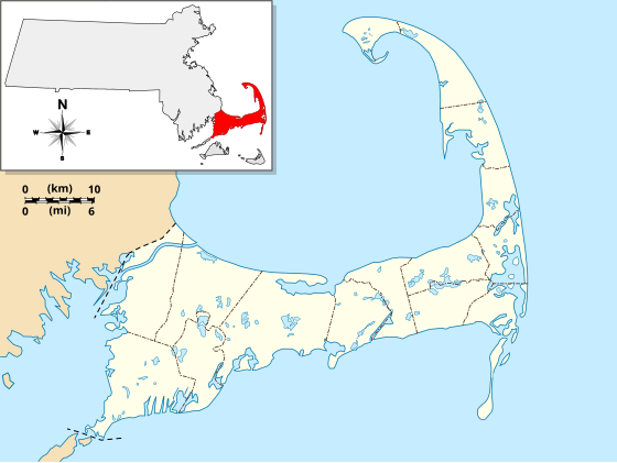
ไฟล์:USA Mass Cape Cod location map.svg

ขนาดของตัวอย่าง PNG นี้ของไฟล์ SVG นี้: 560 × 420 พิกเซล ความละเอียดอื่น: 320 × 240 พิกเซล | 640 × 480 พิกเซล | 1,024 × 768 พิกเซล | 1,280 × 960 พิกเซล | 2,560 × 1,920 พิกเซล
ดูภาพที่มีความละเอียดสูงกว่า ((ไฟล์ SVG, 560 × 420 พิกเซล, ขนาดไฟล์: 264 กิโลไบต์))
ประวัติไฟล์
คลิกวันที่/เวลาเพื่อดูไฟล์ที่ปรากฏในขณะนั้น
| วันที่/เวลา | รูปย่อ | ขนาด | ผู้ใช้ | ความเห็น | |
|---|---|---|---|---|---|
| ปัจจุบัน | 18:25, 13 พฤษภาคม 2556 |  | 560 × 420 (264 กิโลไบต์) | Grolltech | reshaped Monomoy; added overlay layers to facilitate reuse of this file |
| 05:45, 8 พฤษภาคม 2556 |  | 560 × 420 (189 กิโลไบต์) | Grolltech | further reduced thickness of town boundaries, land outlines | |
| 15:10, 6 พฤษภาคม 2556 |  | 560 × 420 (206 กิโลไบต์) | Grolltech | moved compass rose out of the way | |
| 00:39, 1 มิถุนายน 2555 |  | 560 × 420 (205 กิโลไบต์) | Grolltech | 1) moved scale legend to the left edge, and 2) reduced thickness of town boundaries, land outlines, lakes and ponds. Both of these changes are intended lessen the impact on readability of pushpin labels. | |
| 00:21, 14 พฤษภาคม 2555 |  | 560 × 420 (206 กิโลไบต์) | Grolltech | added town boundaries | |
| 12:51, 13 พฤษภาคม 2555 |  | 560 × 420 (190 กิโลไบต์) | Grolltech | {{Information |Description ={{en|1=Locator Map for Cape Cod exclusively. Made for "Wikiproject Massachusetts - Cape Cod and the Islands". Equirectangular projection, N/S stretching 130.0 %. Geographic limits of the map: Northern boundary: 42.104... |
หน้าที่มีภาพนี้
หน้าต่อไปนี้ โยงมาที่ภาพนี้:
การใช้ไฟล์ข้ามโครงการ
วิกิอื่นต่อไปนี้ใช้ไฟล์นี้:
- การใช้บน ar.wikipedia.org
- การใช้บน azb.wikipedia.org
- การใช้บน ceb.wikipedia.org
- การใช้บน en.wikipedia.org
- Cape Cod
- Cape Cod Canal
- Provincetown Harbor
- Cape Cod Baseball League
- Eastham Windmill
- Sagamore Beach, Massachusetts
- Attaquin Beach
- Provincetown Historic District
- Race Point Light
- Center Methodist Church
- Provincetown Public Library (old)
- North Truro Air Force Station
- South Harwich, Massachusetts
- Hyannis Armory
- Louis Brandeis House
- Nauset Archeological District
- Ancient Burying Ground
- Chatham Windmill
- First Universalist Church (Provincetown, Massachusetts)
- Adams-Crocker-Fish House
- South Harwich Methodist Church
- Osterville Baptist Church
- Old Higgins Farm Windmill
- Universalist Society Meetinghouse
- Poor House and Methodist Cemetery
- Cove Burying Ground
- Bridge Road Cemetery
- Old Indian Meeting House
- Ahearn House and Summer House
- Josiah A. Ames House
- Atwood–Higgins Historic District
- Barnstable County Courthouse
- Avant House (Mashpee, Massachusetts)
- Capt. Rodney J. Baxter House
- George I. Briggs House
- Benjamin Baker Jr. House
- Capt. Seth Baker Jr. House
- Nathaniel Baker House
- Baxter Mill
- Lemuel B. Chase House
- Canary-Hartnett House
- Brewster Old King's Highway Historic District
- Thomas Bray Farm
ดูการใช้ข้ามโครงการเพิ่มเติมของไฟล์นี้
