
ไฟล์:Long Island US map.gif
ไม่มีภาพที่มีรายละเอียดสูงกว่านี้
Long_Island_US_map.gif (422 × 359 พิกเซล, ขนาดไฟล์: 15 กิโลไบต์, ชนิดไมม์: image/gif)
| รูปภาพหรือไฟล์เสียงนี้ ต้นฉบับอยู่ที่ คอมมอนส์ รายละเอียดด้านล่าง เป็นข้อความที่แสดงผลจาก ไฟล์ต้นฉบับในคอมมอนส์
|
ความย่อ
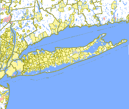
| คำอธิบาย |
English: US Government Census map of Long Island. |
| แหล่งที่มา | http://tiger.census.gov/cgi-bin/mapsurfer?infact=2&outfact=2&act=move&tlevel=-&tvar=-&tmeth=i&mlat=&mlon=&msym=bigdot&mlabel=&murl=&lat=40.8744240&lon=-72.9908829&wid=1.492&ht=1.492&conf=mapnew |
| ผู้สร้างสรรค์ |
การอนุญาตใช้สิทธิ
This image or file is a work of a United States Census Bureau employee, taken or made as part of that person's official duties. As a work of the U.S. federal government, the image is in the public domain.
|
 |
บันทึกการอัพโหลด
นำเข้าจาก en.wikipedia มายังคอมมอนส์ โดย Quibik โดยใช้ CommonsHelper
The original description page was here. All following user names refer to en.wikipedia.
- 2007-01-22 19:12 Badagnani 422×359× (15241 bytes) US Government Census map of [[Long Island, New York]]. From http://tiger.census.gov/cgi-bin/mapsurfer?infact=2&outfact=2&act=move&tlevel=-&tvar=-&tmeth=i&mlat=&mlon=&msym=bigdot&mlabel=&murl=&lat=40.8744240&lon=-72.9908829&wid=1.492&ht=1.492&conf=mapnew.
ประวัติไฟล์
คลิกวันที่/เวลาเพื่อดูไฟล์ที่ปรากฏในขณะนั้น
| วันที่/เวลา | รูปย่อ | ขนาด | ผู้ใช้ | ความเห็น | |
|---|---|---|---|---|---|
| ปัจจุบัน | 10:11, 15 มกราคม 2555 | | 422 × 359 (15 กิโลไบต์) | File Upload Bot (Magnus Manske) | {{BotMoveToCommons|en.wikipedia|year={{subst:CURRENTYEAR}}|month={{subst:CURRENTMONTHNAME}}|day={{subst:CURRENTDAY}}}} {{Information |Description={{en|US Government Census map of en:Long Island, New York. From http://tiger.census.gov/cgi-bin/mapsu |
หน้าที่มีภาพนี้
ไม่มีหน้าใดโยงมาที่ภาพนี้
การใช้ไฟล์ข้ามโครงการ
วิกิอื่นต่อไปนี้ใช้ไฟล์นี้:
- การใช้บน bn.wikipedia.org
- การใช้บน el.wikipedia.org
- การใช้บน en.wikipedia.org
- การใช้บน pnb.wikipedia.org