
ไฟล์:Locatie Floreszee.PNG
ไม่มีภาพที่มีรายละเอียดสูงกว่านี้
Locatie_Floreszee.PNG (484 × 362 พิกเซล, ขนาดไฟล์: 12 กิโลไบต์, ชนิดไมม์: image/png)
| รูปภาพหรือไฟล์เสียงนี้ ต้นฉบับอยู่ที่ คอมมอนส์ รายละเอียดด้านล่าง เป็นข้อความที่แสดงผลจาก ไฟล์ต้นฉบับในคอมมอนส์
|
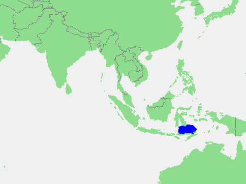
| คำอธิบาย | Flores Sea | ||||
| แหล่งที่มา | own work based on PD map | ||||
| ผู้สร้างสรรค์ | edited by M.Minderhoud | ||||
| การอนุญาต (การใช้ไฟล์นี้ใหม่) |
|
ประวัติไฟล์
คลิกวันที่/เวลาเพื่อดูไฟล์ที่ปรากฏในขณะนั้น
| วันที่/เวลา | รูปย่อ | ขนาด | ผู้ใช้ | ความเห็น | |
|---|---|---|---|---|---|
| ปัจจุบัน | 19:37, 17 กันยายน 2549 | | 484 × 362 (12 กิโลไบต์) | Michiel1972 | {{Information |Description= Flores Sea |Source= own work based on PD map |Date= |Author= edited by M.Minderhoud |Permission= {{PD-Demis}} |other_versions= }} category:Locator maps of seas |
หน้าที่มีภาพนี้
หน้าต่อไปนี้ โยงมาที่ภาพนี้:
การใช้ไฟล์ข้ามโครงการ
วิกิอื่นต่อไปนี้ใช้ไฟล์นี้:
- การใช้บน af.wikipedia.org
- การใช้บน an.wikipedia.org
- การใช้บน ar.wikipedia.org
- การใช้บน avk.wikipedia.org
- การใช้บน az.wikipedia.org
- การใช้บน ban.wikipedia.org
- การใช้บน ba.wikipedia.org
- การใช้บน be-tarask.wikipedia.org
- การใช้บน br.wikipedia.org
- การใช้บน bs.wikipedia.org
- การใช้บน ca.wikipedia.org
- การใช้บน cs.wikipedia.org
- การใช้บน cv.wikipedia.org
- การใช้บน da.wikipedia.org
- การใช้บน de.wikipedia.org
- การใช้บน el.wikipedia.org
- การใช้บน en.wikipedia.org
- การใช้บน eo.wikipedia.org
- การใช้บน es.wikipedia.org
- การใช้บน fa.wikipedia.org
- การใช้บน fi.wikipedia.org
- การใช้บน frr.wikipedia.org
- การใช้บน fr.wikipedia.org
- การใช้บน fy.wikipedia.org
- การใช้บน gl.wikipedia.org
- การใช้บน id.wikipedia.org
- การใช้บน ilo.wikipedia.org
- การใช้บน is.wikipedia.org
- การใช้บน it.wikipedia.org
- การใช้บน ja.wikipedia.org
- การใช้บน jv.wikipedia.org
- การใช้บน ka.wikipedia.org
- การใช้บน kk.wikipedia.org
- การใช้บน ko.wikipedia.org
- การใช้บน la.wikipedia.org
- การใช้บน lt.wikipedia.org
- การใช้บน mhr.wikipedia.org
- การใช้บน mk.wikipedia.org
- การใช้บน ml.wikipedia.org
- การใช้บน ms.wikipedia.org
- การใช้บน nl.wikipedia.org
- การใช้บน nn.wikipedia.org
- การใช้บน no.wikipedia.org
ดูการใช้ข้ามโครงการเพิ่มเติมของไฟล์นี้