
ไฟล์:15th century map of Turkey region.jpg
ขนาดของตัวอย่างนี้: 800 × 600 พิกเซล ความละเอียดอื่น: 320 × 240 พิกเซล | 640 × 480 พิกเซล | 1,024 × 768 พิกเซล | 1,280 × 960 พิกเซล | 2,048 × 1,536 พิกเซล
ดูภาพที่มีความละเอียดสูงกว่า (2,048 × 1,536 พิกเซล, ขนาดไฟล์: 884 กิโลไบต์, ชนิดไมม์: image/jpeg)
| รูปภาพหรือไฟล์เสียงนี้ ต้นฉบับอยู่ที่ คอมมอนส์ รายละเอียดด้านล่าง เป็นข้อความที่แสดงผลจาก ไฟล์ต้นฉบับในคอมมอนส์
|
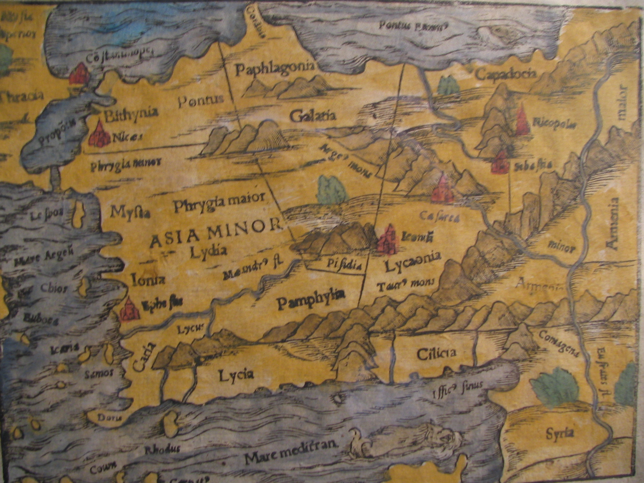
| คำอธิบาย |
English: Picture of a map of the region of what is now Turkey from the 15th Century. I own this map, having purchased it, and have all official documentation regarding its authenticity. |
||||
| วันที่ | 15 century, Digitized on: 10 ธันวาคม พ.ศ. 2549, 19:42:23 | ||||
| แหล่งที่มา |
|
||||
| ผู้สร้างสรรค์ | Unknown author, Photographer: Electionworld | ||||
| การอนุญาต (การใช้ไฟล์นี้ใหม่) |
ไฟล์นี้อยู่ภายใต้สัญญาอนุญาต ครีเอทีฟคอมมอนส์ แบบแสดงที่มา-อนุญาตแบบเดียวกัน 2.5 ทั่วไป
|
||||

ประวัติไฟล์
คลิกวันที่/เวลาเพื่อดูไฟล์ที่ปรากฏในขณะนั้น
| วันที่/เวลา | รูปย่อ | ขนาด | ผู้ใช้ | ความเห็น | |
|---|---|---|---|---|---|
| ปัจจุบัน | 21:04, 21 กุมภาพันธ์ 2561 | | 2,048 × 1,536 (884 กิโลไบต์) | Ket | Reverted to version as of 09:40, 17 December 2006 (UTC) |
| 21:03, 21 กุมภาพันธ์ 2561 |  | 2,048 × 1,536 (921 กิโลไบต์) | Ket | better contrast | |
| 16:40, 17 ธันวาคม 2549 |  | 2,048 × 1,536 (884 กิโลไบต์) | Electionworld | {{ew|en|Rarelibra}} == Summary == Picture of a map of the region of what is now Turkey from the 15th Century. I own this map, having purchased it, and have all official documentation regarding its authenticity. == Licensing == {{cc-by-sa-2.5}} |
หน้าที่มีภาพนี้
หน้าต่อไปนี้ โยงมาที่ภาพนี้:
การใช้ไฟล์ข้ามโครงการ
วิกิอื่นต่อไปนี้ใช้ไฟล์นี้:
- การใช้บน ar.wikipedia.org
- การใช้บน ast.wikipedia.org
- การใช้บน bg.wikipedia.org
- การใช้บน ca.wikipedia.org
- การใช้บน cs.wikipedia.org
- การใช้บน da.wikipedia.org
- การใช้บน de.wikipedia.org
- การใช้บน el.wikipedia.org
- การใช้บน en.wikipedia.org
- การใช้บน eo.wikipedia.org
- การใช้บน es.wikipedia.org
- การใช้บน eu.wikipedia.org
- การใช้บน fr.wikipedia.org
- การใช้บน gl.wikipedia.org
- การใช้บน hr.wikipedia.org
ดูการใช้ข้ามโครงการเพิ่มเติมของไฟล์นี้