แม่แบบ:Location map many
| แม่แบบนี้ใช้ลูอา |
การใช้งาน[แก้]
ส่วนนี้รอเพิ่มเติมข้อมูล คุณสามารถช่วยเพิ่มข้อมูลส่วนนี้ได้ |
Examples[แก้]
Map with label "Pag" and "Anytown" (degrees)[แก้]
Recommended syntax
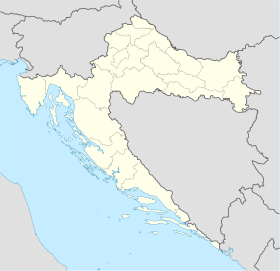
{{Location map many | Croatia
| width = 280
| float = right
| label = Pag
  | marksize = 8
  | pos = right
  | bg = yellow
  | coordinates = {{coord|44|26|N|15|3|E}}
| label2 = Anytown_Anywhere
  | mark2 = Rouge-Admin JollyRoger.svg
  | mark2size = 45
  | pos2 = top
  | bg2 = white
  | coordinates2 = {{coord|46|30|N|17|30|E}}
}}
Alternative syntax
{{Location map many | Croatia
| width = 280
| float = right
| label = Pag
  | marksize = 8
  | pos = right
  | bg = yellow
  | lat_deg = 44 | lat_min = 26
  | lon_deg = 15 | lon_min = 3
| label2 = Anytown_Anywhere
  | mark2 = Rouge-Admin JollyRoger.svg
  | mark2size = 45
  | pos2 = top
  | bg2 = white
  | lat2_deg = 46 | lat2_min = 30
  | lon2_deg = 17 | lon2_min = 30
}}
Map with 3 labels (decimal)[แก้]
Recommended syntax
{{Location map many | Croatia
| width = 260
| float = right
| label = Pag
  | pos = right
  | marksize = 8
  | coordinates = {{coord|44.44|15.05}}
| label2 = Anytown
  | pos2 = bottom
  | bg2 = yellow
  | mark2size = 8
  | coordinates2 = {{coord|45.86|17.50}}
| label3 = Anytown2
  | pos3 = top
  | bg3 = lightgreen
  | coordinates3 = {{coord|46.23|18.43}}
}}
Alternative syntax
{{Location map many | Croatia
| width = 260
| float = right
| label = Pag
  | pos = right
  | marksize = 8
  | lat_deg = 44.44
  | lon_deg = 15.05
| label2 = Anytown
  | pos2 = bottom
  | bg2 = yellow
  | mark2size = 8
  | lat2_deg = 45.86
  | lon2_deg = 17.50
| label3 = Anytown2
  | pos3 = top
  | bg3 = lightgreen
  | lat3_deg = 46.23
  | lon3_deg = 18.43
}}
Example map with red diamond[แก้]
{{Location map many | 100x100
| AlternativeMap = LocationJamaica.svg
| float = right
| width = 250
| caption = Site of '''Hispaniola'''
| label = Hispaniola
  | position = left
  | background = #CCDDFF
  | marksize = 1
  | coordinates = {{coord|38.2|69.3}}
| label2 =
  | mark2 =Diamond_sheer_red_37.png
  | mark2size = 42
  | coordinates2 = {{coord|52.2|73.9}}
| label3 = Cuba
  | pos3 = left
  | mark3size = 1
  | coordinates3 = {{coord|59.2|68.0}}
}}
Map with some labels outside map[แก้]
{{Location map many | Croatia
| width = 260
| float = right
| label = Pag | position=right
  | marksize = 8
  | coordinates = {{coord|44.44|15.05}}
| label2 = Anytown
  | pos2 = bottom
  | bg2 = yellow
  | coordinates2 = {{coord|47.40|12.80}}
  | outside2 = 1 <!-- we know this point is outside the map, so don't warn about it -->
| label3 = Anytown2
  | pos3 = top
  | bg3 = lightgreen
  | coordinates3 = {{coord|41.98|18.43}}
  | outside3 = 1 <!-- we know this point is outside the map, so don't warn about it -->
| label4 = North Croatia
  | pos4 = left
  | bg4 = lightgreen
  | mark4size = 0
  | coordinates4 = {{coord|46.22|17.7}}
}}
Map with 9 markers (decimal)[แก้]
{{Location map many | Croatia
| width = 260
| float = right
| label = Pag
  | position = right
  | coordinates = {{coord|44.44|15.05}}
| label2 = Anytown
  | label2_size = 110
  | pos2 = bottom
  | background2 = yellow
  | coordinates2 = {{coord|45.86|17.50}}
| label3 = Anytown2
  | label3_size = 290
  | pos3 = top
  | background3 = green
  | coordinates3 = {{coord|46.23|18.43}}
| mark4 =Diamond_sheer_black_20.png
  | mark4size = 19
  | label4 = 44.0 (latitude)
  | coordinates4 = {{coord|44.00|13.5}}
| mark5 =Diamond_sheer_black_20.png
  | mark5size = 20
  | label5 = 44.5
  | coordinates5 = {{coord|44.50|13.5}}
| mark6 =Diamond_sheer_black_20.png
  | mark6size = 20
  | label6 = 45.0
  | coordinates6 = {{coord|45.00|13.5}}
| mark7 =Diamond_sheer_black_20.png
  | mark7size = 20
  | label7 = 45.5
  | coordinates7 = {{coord|45.50|13.5}}
| mark8 =Diamond_sheer_black_20.png
  | mark8size = 20
  | label8 = 46.0
  | coordinates8 = {{coord|46.00|13.5}}
| label9 = ''CROATIA''
  | label9_size = 165
  | mark9size = <!--label only-->1
  | coordinates9 = {{coord|42.60|14.4}}
}}
Map with a custom label and text background[แก้]
{{Location map many | Croatia
| width = 280
| float = right
| caption = Imotski in Croatia
| label = Imotski
| position = right
| background = #FFFFDD
| coordinates = {{coord|43.44|17.21}}
}}
Map with enlarged marker and label[แก้]
{{Location map many | Croatia
| width = 260
| float = right
| caption = Pag Island in Croatia
| label = Pag
| label_size = 200
| position = right
| marksize = 14
| background = #FFFFDD
| coordinates = {{coord|44.44|15.05}}
}}
Map with no caption[แก้]
ข้อผิดพลาด Lua ใน มอดูล:Location_map/multi บรรทัดที่ 143: Unable to find the specified location map definition: "Module:Location map/data/Bosnia" does not exist
{{Location map many | Bosnia
| width = 150
| float = right
| caption =
| label = Brčko
| position = left
| coordinates = {{coord|44.87|18.81}}
}}
Western Hemisphere[แก้]
{{Location map many | United Kingdom
| width = 180
| float = right
| caption = Lockerbie in Scotland
| label = Lockerbie
| position = right
| coordinates = {{coord|55|07|16|N|3|21|19|W}}
}}
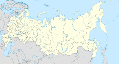
Country that crosses 180° meridian[แก้]
{{Location map many | Russia
| width = 400
| float = right
| label = Uelen
| position = left
| background = #FFFFDD
| coordinates = {{coord|66|09|N|169|48|W}}
}}
Marker examples[แก้]

Pfeil oben.svg
Pfeil unten.svg
Pfeil rechts.svg
Pfeil links.svg
Pfeil rechts oben.svg
Pfeil rechts unten.svg
Pfeil links oben.svg
Pfeil links unten.svg
Point carte.svg
Square city locator.png
Red.svg
Solid blue.svg
Fadenkreuz.svg
Crosshairs Red.svg
Purple pog.svg
Yellow pog.svg
Map-Pin.png
Dot-yellow.svg
Blue-circle.gif
Flashspot.gif
Location dot blue.svg
Location dot black.svg
Arrows 12x12 nw.svg
Arrows 12x12 ne.svg
Fire.svg
Black triangle2.svg
Blue Fire.svg
City locator Montagne.svg
Cercle rouge 100%.svg
White flag icon.svg
Legenda miejsce bitwy.svg
X solid black 17.gif

City locator 0.svg
City locator 1.svg
City locator 2.svg
City locator 6.svg
City locator 7.svg
City locator 8.svg
City locator 9.svg
City locator 10.svg
City locator 11.svg
City locator 13.svg
City locator 21.svg
City locator 29.svg
Point rouge croix frontier vert green.svg
Wikipedia-Marker-4.png
StarArrowOR.svg
Castle.svg
Crime_symbol_handgun_czeska80px.png
Gwiazda LnM.svg
Nuclear plant.svg
Quake pointer.svg
Rotonda S7.svg
Wikipedia-Marker-isle.svg
BSicon dB+Slg.svg
BSicon ANCHOR.svg
BSicon fSKRZ-Bu.svg
BSicon xtGRENZE.svg
Unesco Cultural Heritage logo.svg
Mining symbol.svg
Zoo icon.jpg
Vattenfall blue.svg
SymbolAirport.svg
- See Wikimedia pointer symbols: commons:Category:Map pointers.
ดูเพิ่ม[แก้]
- Template:Location map - placing one marker/label by latitude/longitude.
- Template:Location map+ - placing unlimited list of markers/labels.
- Commons:Category:Map pointers - list of the many Wikimedia Commons pointer symbols.
| คู่มือการใช้งานที่ปรากฏด้านบนนี้ดึงมาจาก แม่แบบ:Location map many/doc (แก้ | ประวัติ) ผู้เขียนสามารถทำการทดลองได้ที่กระบะทราย (สร้าง | คัดลอก) และชุดทดสอบ (สร้าง) ของแม่แบบนี้ โปรดเพิ่มหมวดหมู่ไปที่หน้าย่อย /doc หน้าย่อยของแม่แบบนี้ |


